Air Ambulance Helicopter to Hady, Lee Road
Tuesday, 20 January 2026 | 14:52 | From Barrow Hill
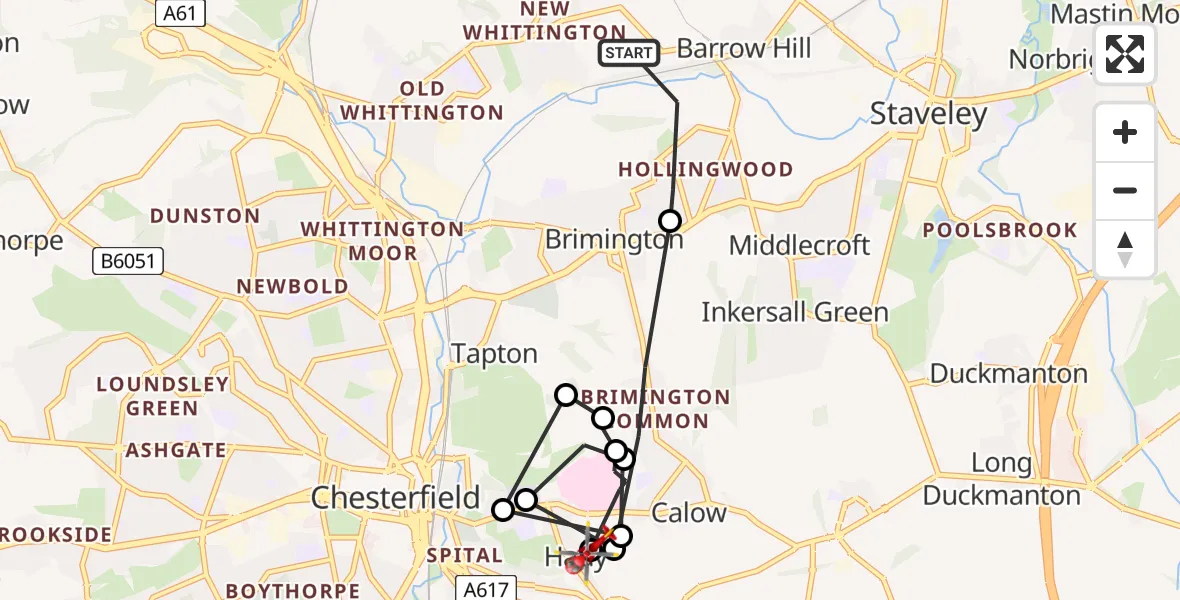
On Tuesday, 20 January 2026 at 14:52, a Air Ambulance Helicopter departed from Barrow Hill to Hady. It was the Air Ambulance Helicopter with registration number G-DRLA. The flight lasted 5 minutes. During that period, the aircraft travelled 8 miles at an average speed of 93 miles per hour at a maximum altitude of 1750 feet.
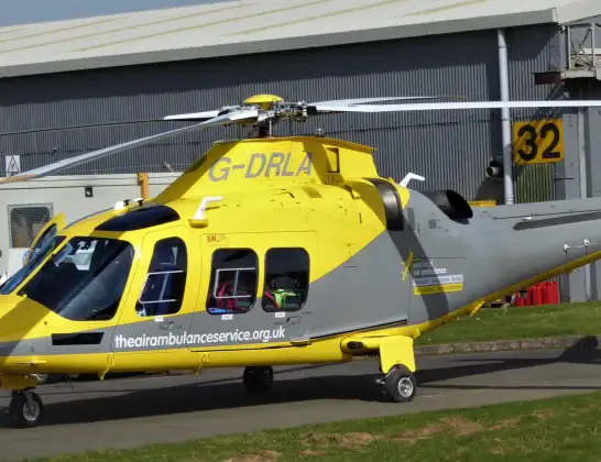
Helicopter: G-DRLA
The helicopter G-DRLA is used as an ambulance helicopter. The helicopter is equipped with a stretcher for transporting patients. The helicopter is often used to transport to hospitals.
Photo: Alec Wilson
8 miles
1750 feet
93 mph
5 minutes
14:52
14:57

Route
Lee Road, Chesterfield14:57
Hady, Chesterfield14:57
Calow, Chesterfield14:56
Hady, Chesterfield14:56
Tapton, Chesterfield14:55
Hady, Chesterfield14:55
Calow, North East Derbyshire14:55
Calow, Chesterfield14:54
Hady, Chesterfield14:54
Calow, North East Derbyshire14:54
Brimington CP, Chesterfield14:53
Whittington Road, Chesterfield14:52
Today
Police Helicopter to Epping Forest, Green Lane26 Feb 23:43
Flights Hady
Air Ambulance Helicopter to Hady, Lee Road20 Jan 14:52
Helicopter flights on your website?
You can easily display helicopter flights on your own website. Use the embed code.
