Police Helicopter to Llanmaes, Llanmaes
Tuesday, 20 January 2026 | 13:12 | From Cilfynydd
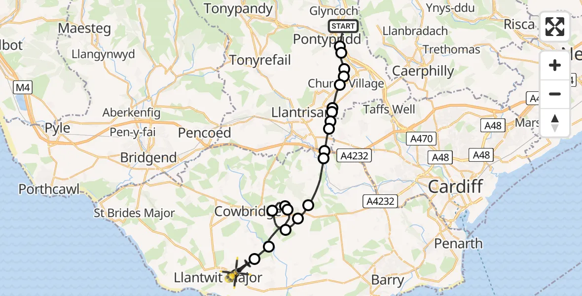
On Tuesday, 20 January 2026 at 13:12, a Police Helicopter departed from Cilfynydd to Llanmaes. It was the Police Helicopter with registration number G-NWOI. The flight lasted 12 minutes. During that period, the aircraft travelled 20 miles at an average speed of 96 miles per hour at a maximum altitude of 1750 feet.
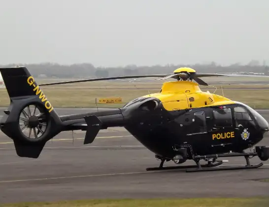
Helicopter: G-NWOI
The helicopter G-NWOI is used by the British police. The helicopter is deployed in pursuits, missing persons cases and other incidents where a helicopter provides added value.
Photo: James from Cheltenham
20 miles
1750 feet
96 mph
13 minutes
13:12
13:24

Route
Llanmaes, 13:24
Eglwys Brewis13:24
St Mary Church13:23
St Hilary13:21
Welsh St. Donats13:21
Aberthin13:20
St Hilary13:19
Llancarfan13:19
Bonvilston13:18
Pendoylan13:16
Peterston-super-Ely13:16
Groes-faen13:15
Cardiff13:15
Llantrisant13:15
Efail Isaf13:15
Llantwit Fardre13:14
Hawthorn13:14
Rhydyfelin13:13
Hawthorn, Pontypridd13:13
Y Graig, Pontypridd13:13
Brookfield Lane, Pontypridd13:12
Live flights
Today
Police Helicopter to Epping Forest, Green Lane26 Feb 23:43
Flights Llanmaes
Police Helicopter to MOD St Athan, MOD St Athan19 Feb 14:27
Police Helicopter to Boverton, B42654 Feb 16:13
to Pyle, Ffordd yr Eglwys23 Jan 10:37
Police Helicopter to Llanmaes, Llanmaes20 Jan 13:12
Flights Cilfynydd
Police Helicopter to Llanmaes, Llanmaes20 Jan 13:12
Helicopter flights on your website?
You can easily display helicopter flights on your own website. Use the embed code.
