Air Ambulance Helicopter to Weymouth, Chickerell Road
Tuesday, 20 January 2026 | 8:31 | From Henstridge Airfield
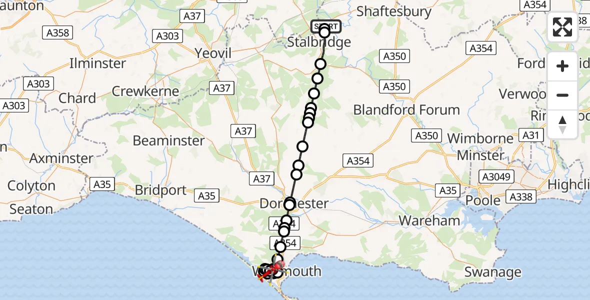
On Tuesday, 20 January 2026 at 8:31, a Air Ambulance Helicopter departed from Henstridge Airfield to Weymouth. It was the Air Ambulance Helicopter with registration number G-DSAA. The flight lasted 18 minutes. During that period, the aircraft travelled 30 miles at an average speed of 102 miles per hour at a maximum altitude of 1400 feet.
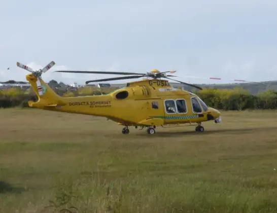
Helicopter: G-DSAA
The helicopter G-DSAA is used as a air ambulance helicopter. The main purpose of this aircraft is to transport a Mobile Medical Team to an incident as quickly as possible, enabling the trauma doctor to provide immediate first aid on site. The aircraft is flying this flight as Air Ambulance Helicopter.
Photo: Andrew Bone
31 miles
1400 feet
102 mph
18 minutes
08:31
08:49

Route
Chickerell Road, 08:49
Weymouth08:48
Chickerell08:48
Fleet08:48
The Fleet08:47
Wyke Regis, Chickerell08:47
Weymouth08:47
Chickerell08:47
Weymouth08:46
Wyke Regis, Weymouth08:46
Chickerell08:45
Weymouth08:45
Nottington, Weymouth08:44
Upwey, Weymouth08:43
Upwey08:43
Winterborne Monkton08:42
Dorchester08:41
Dorchester Hospital, Dorchester08:41
Charminster08:40
Piddlehinton08:39
Piddletrenthide08:38
Plush08:37
Mappowder08:37
Buckland Newton08:36
Mappowder08:36
Pulham08:35
King's Stag08:35
Lydlinch08:34
Stalbridge08:32
Henstridge08:31
Henstridge Airfield, Templecombe, Somerset08:31
Live flights
Today
Police Helicopter to Epping Forest, Green Lane26 Feb 23:43
Flights Weymouth
Police Helicopter to Weymouth, Hampshire Road10 Feb 11:19
Helicopter flights on your website?
You can easily display helicopter flights on your own website. Use the embed code.
