Police Helicopter to Brockhall Village, Ribchester Road
Tuesday, 20 January 2026 | 0:19 | From Manchester Barton Aerodrome
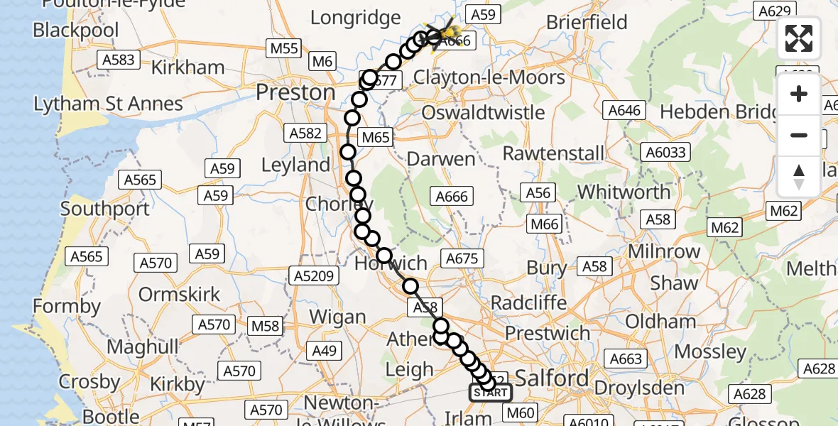
On Tuesday, 20 January 2026 at 0:19, a Police Helicopter departed from Manchester Barton Aerodrome to Brockhall Village. It was the Police Helicopter with registration number G-EMID. The flight lasted 12 minutes. During that period, the aircraft travelled 31 miles at an average speed of 161 miles per hour at a maximum altitude of 1600 feet.
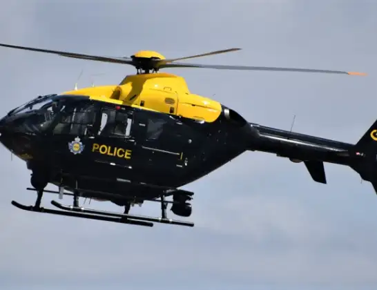
Helicopter: G-EMID
The helicopter G-EMID is used by the British police. The helicopter is deployed in pursuits, missing persons cases and other incidents where a helicopter provides added value.
Photo: Alec Wilson
32 miles
1600 feet
161 mph
12 minutes
00:19
00:31

Route
Ribchester Road, Ribble Valley00:31
Brockhall Village, Ribble Valley00:31
Ribble Valley, Lancashire00:30
Copster Green, Ribble Valley00:30
Ribble Valley, Lancashire00:30
Osbaldeston, Ribble Valley00:29
Balderstone, Ribble Valley00:29
South Ribble, Lancashire00:28
Coupe Green, South Ribble00:28
Coupe Green, Chorley00:27
Brindle, Chorley00:27
Wheelton, Chorley00:26
Chorley, Lancashire00:25
Rivington, Chorley00:25
Heath Charnock, Chorley00:25
Rivington, Chorley00:24
Chorley, Lancashire00:24
Horwich, Greater Manchester00:23
Bolton, Greater Manchester00:22
Shakerley, Wigan00:21
Salford, Greater Manchester00:21
Mosley Common, Wigan00:21
Worsley, Salford00:21
Boothstown, Salford00:20
Worsley, Salford00:20
Boothstown, Salford00:20
Worsley, Salford00:20
Twelve Yards Road, Salford00:19
Live flights
Today
Police Helicopter to Epping Forest, Green Lane26 Feb 23:43
Helicopter flights on your website?
You can easily display helicopter flights on your own website. Use the embed code.
