Air Ambulance Helicopter to Coventry Airport, Coventry Airport
Saturday, 17 January 2026 | 16:39 | From Swithland
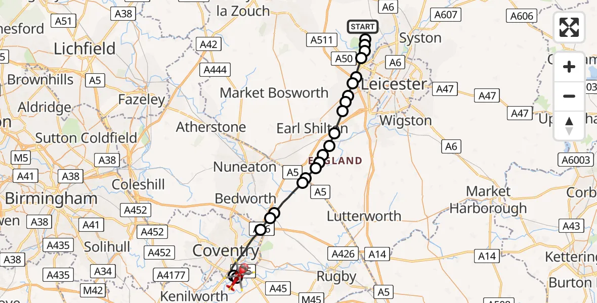
On Saturday, 17 January 2026 at 16:39, a Air Ambulance Helicopter departed from Swithland to Coventry Airport. It was the Air Ambulance Helicopter with registration number G-WNAS. The flight lasted 12 minutes. During that period, the aircraft travelled 28 miles at an average speed of 140 miles per hour at a maximum altitude of 1275 feet.
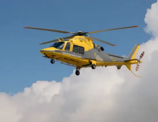
Helicopter: G-WNAS
The helicopter G-WNAS is used as an ambulance helicopter. The helicopter is equipped with a stretcher for transporting patients. The helicopter is often used to transport to hospitals.
Photo: Tony Melony
29 miles
1275 feet
140 mph
13 minutes
16:39
16:51

Route
Coventry Airport, Coventry, West Midlands16:51
Coventry Airport, Coventry, West Midlands16:51
Baginton, Warwick16:50
Coventry, West Midlands16:48
Ansty CP, Rugby16:47
Shilton, Rugby16:47
Wolvey CP, Rugby16:46
Hinckley and Bosworth16:45
Blaby16:45
Sharnford16:45
Sapcote16:44
Stoney Stanton16:44
Potters Marston16:43
Thurlaston16:43
New Lubbesthorpe16:42
Leicester Forest East16:42
Kirby Muxloe16:41
Glenfield16:41
Groby, Hinckley and Bosworth16:40
Anstey, Charnwood16:40
Newtown Linford, Charnwood16:40
Cropston, Charnwood16:40
Main Street, Charnwood16:39
Today
Police Helicopter to Epping Forest, Green Lane26 Feb 23:43
Flights Swithland
Helicopter flights on your website?
You can easily display helicopter flights on your own website. Use the embed code.
