Air Ambulance Helicopter to Woodhouse Eaves, Rawlins Close
Saturday, 17 January 2026 | 15:55 | From Coventry
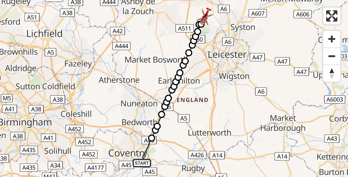
On Saturday, 17 January 2026 at 15:55, a Air Ambulance Helicopter departed from Coventry to Woodhouse Eaves. It was the Air Ambulance Helicopter with registration number G-WNAS. The flight lasted 10 minutes. During that period, the aircraft travelled 27 miles at an average speed of 155 miles per hour at a maximum altitude of 1250 feet.
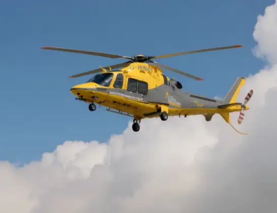
Helicopter: G-WNAS
The helicopter G-WNAS is used as an ambulance helicopter. The helicopter is equipped with a stretcher for transporting patients. The helicopter is often used to transport to hospitals.
Photo: Tony Melony
27 miles
1250 feet
155 mph
11 minutes
15:55
16:05

Route
Rawlins Close, Charnwood16:05
Woodhouse Eaves, Charnwood16:03
Charnwood16:03
Newtown Linford, Charnwood16:03
Markfield, Hinckley and Bosworth16:02
Groby, Hinckley and Bosworth16:02
Hinckley and Bosworth16:02
Botcheston, Hinckley and Bosworth16:01
Desford, Hinckley and Bosworth16:01
Peckleton, Hinckley and Bosworth16:01
Hinckley and Bosworth16:00
Earl Shilton, Hinckley and Bosworth16:00
Barwell, Earl Shilton16:00
Barwell, Hinckley and Bosworth15:59
Hinckley and Bosworth15:59
Hinckley, Hinckley and Bosworth15:59
Stretton Baskerville, Hinckley and Bosworth15:58
Stretton Baskerville, Rugby15:58
Burton Hastings CP, Rugby15:58
Wolvey CP, Rugby15:57
Shilton, Rugby15:57
Ansty CP, Rugby15:56
Yarningale Road, West Midlands15:55
Live flights
Today
Police Helicopter to Epping Forest, Green Lane26 Feb 23:43
Flights Coventry
Helicopter flights on your website?
You can easily display helicopter flights on your own website. Use the embed code.
