Air Ambulance Helicopter to Bristol Royal Infirmary, Bristol Royal Infirmary
Saturday, 17 January 2026 | 14:51 | From Yatton
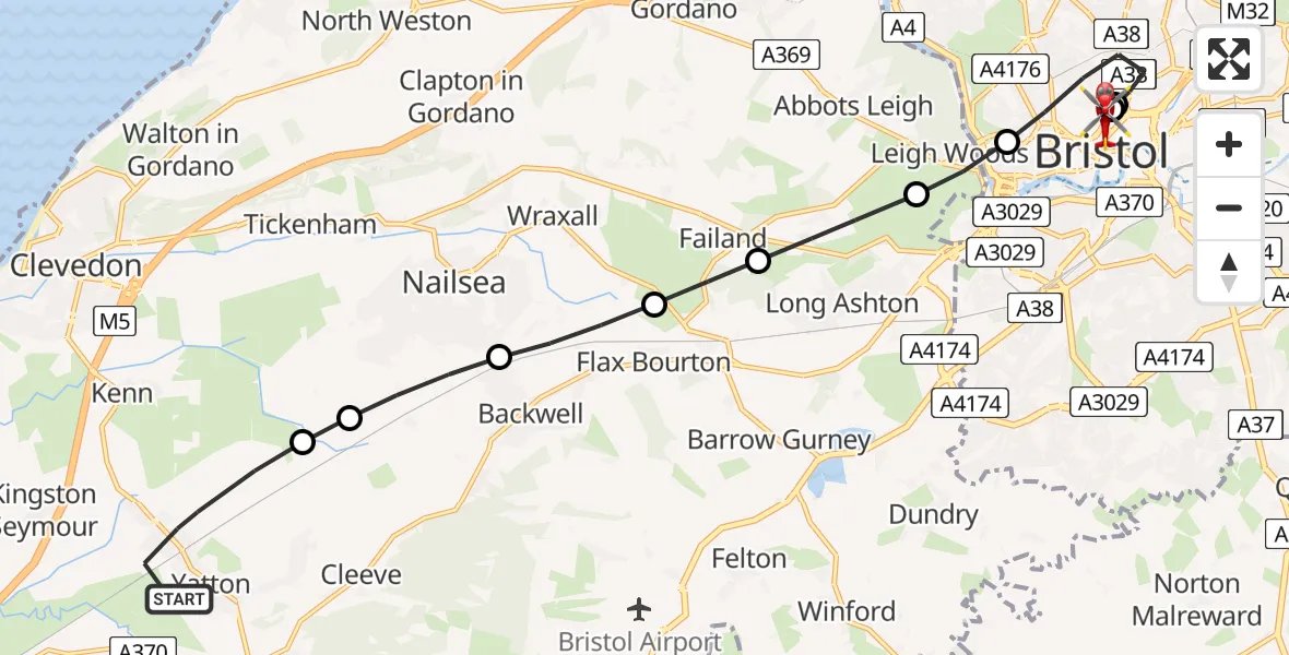
On Saturday, 17 January 2026 at 14:51, a Air Ambulance Helicopter departed from Yatton to Bristol Royal Infirmary. It was the Air Ambulance Helicopter with registration number G-GWAC. The flight lasted 11 minutes. During that period, the aircraft travelled 13 miles at an average speed of 72 miles per hour at a maximum altitude of 1300 feet.
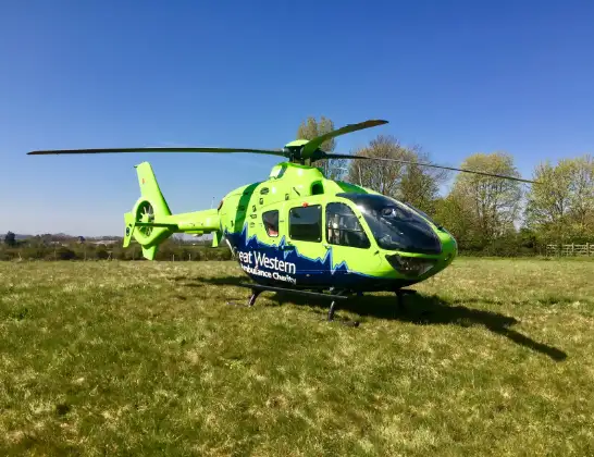
Helicopter: G-GWAC
The helicopter G-GWAC is used as a air ambulance helicopter. The main purpose of this aircraft is to transport a Mobile Medical Team to an incident as quickly as possible, enabling the trauma doctor to provide immediate first aid on site. The aircraft is flying this flight as Air Ambulance Helicopter.
Photo: Mojo0306
14 miles
1300 feet
72 mph
12 minutes
14:51
15:02

Route
Bristol Royal Infirmary, Bristol15:02
Bristol Royal Infirmary, Bristol14:59
Bristol Royal Infirmary, Bristol14:58
Bristol Royal Infirmary, Bristol14:58
Bristol Royal Infirmary, Bristol14:57
Bristol Royal Infirmary Helipad, Bristol14:57
Thomas Street, West of England14:57
Bristol, West of England14:56
Leigh Woods14:55
Long Ashton14:55
Flax Bourton14:54
Backwell14:53
Nailsea14:53
Claverham14:52
Wemberham Lane, 14:51
Yatton14:51
Today
Police Helicopter to Epping Forest, Green Lane26 Feb 23:43
Flights Yatton
Helicopter flights on your website?
You can easily display helicopter flights on your own website. Use the embed code.
