Air Ambulance Helicopter to Nether Whitacre, Tamworth Road
Saturday, 17 January 2026 | 12:58 | From RAF Cosford
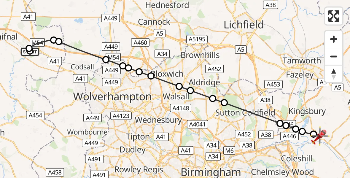
On Saturday, 17 January 2026 at 12:58, a Air Ambulance Helicopter departed from RAF Cosford to Nether Whitacre. It was the Air Ambulance Helicopter with registration number G-RMAA. The flight lasted 15 minutes. During that period, the aircraft travelled 30 miles at an average speed of 120 miles per hour at a maximum altitude of 1300 feet.
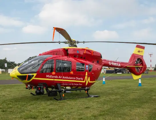
Helicopter: G-RMAA
The helicopter G-RMAA is used as a air ambulance helicopter. The main purpose of this aircraft is to transport a Mobile Medical Team to an incident as quickly as possible, enabling the trauma doctor to provide immediate first aid on site. The aircraft is flying this flight as Air Ambulance Helicopter.
Photo: Steve Lynes
31 miles
1300 feet
120 mph
16 minutes
12:58
13:13

Route
Tamworth Road, North Warwickshire13:13
Nether Whitacre, North Warwickshire13:12
Whitacre Heath, North Warwickshire13:12
Lea Marston, North Warwickshire13:12
Curdworth, North Warwickshire13:11
North Warwickshire, West Midlands13:11
Sutton Coldfield, Birmingham13:08
Streetly, Walsall13:08
Aldridge, West Midlands13:07
Rushall, Walsall13:06
Bloxwich, West Midlands13:05
Wednesfield, Wolverhampton13:05
Essington, South Staffordshire13:04
Wednesfield, Wolverhampton13:04
Wolverhampton, West Midlands13:03
South Staffordshire13:01
Cosford13:01
M54, 13:00
Tong12:59
Cosford12:58
RAF Cosford, Cosford12:58
Today
Helicopter flights on your website?
You can easily display helicopter flights on your own website. Use the embed code.
