Air Ambulance Helicopter to Market Bosworth, Barton Road
Saturday, 17 January 2026 | 12:42 | From Coventry
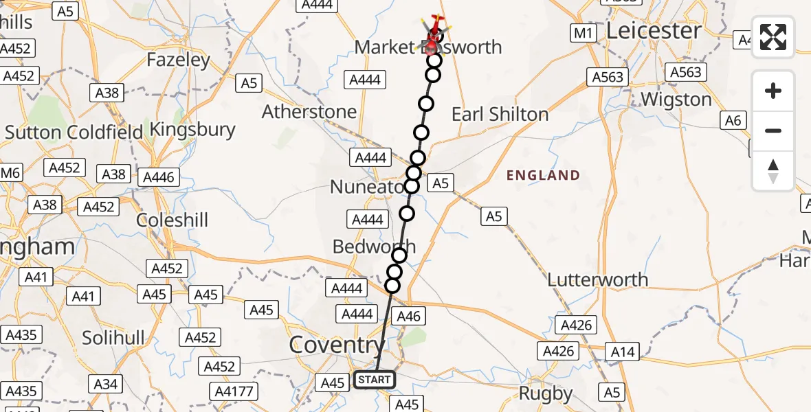
On Saturday, 17 January 2026 at 12:42, a Air Ambulance Helicopter departed from Coventry to Market Bosworth. It was the Air Ambulance Helicopter with registration number G-WNAS. The flight lasted 7 minutes. During that period, the aircraft travelled 18 miles at an average speed of 158 miles per hour at a maximum altitude of 1100 feet.
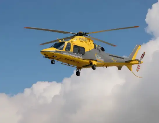
Helicopter: G-WNAS
The helicopter G-WNAS is used as an ambulance helicopter. The helicopter is equipped with a stretcher for transporting patients. The helicopter is often used to transport to hospitals.
Photo: Tony Melony
18 miles
1100 feet
158 mph
7 minutes
12:42
12:49

Route
Barton Road, Hinckley and Bosworth12:49
Osbaston, Hinckley and Bosworth12:49
Market Bosworth, Hinckley and Bosworth12:48
Sutton Cheney, Hinckley and Bosworth12:48
Dadlington, Hinckley and Bosworth12:47
Stoke Golding, Hinckley and Bosworth12:47
Hinckley, Hinckley and Bosworth12:46
Nuneaton and Bedworth12:46
Horeston Grange, Nuneaton and Bedworth12:46
Nuneaton, Nuneaton and Bedworth12:45
Bulkington, Nuneaton and Bedworth12:44
Barnacle, Rugby12:44
Rugby, West Midlands12:44
Wroxall Drive, West Midlands12:42
Today
Police Helicopter to Epping Forest, Green Lane26 Feb 23:43
Flights Coventry
Helicopter flights on your website?
You can easily display helicopter flights on your own website. Use the embed code.
