Air Ambulance Helicopter to Belper Lane End, Belper Lane
Saturday, 17 January 2026 | 12:14 | From Widmerpool
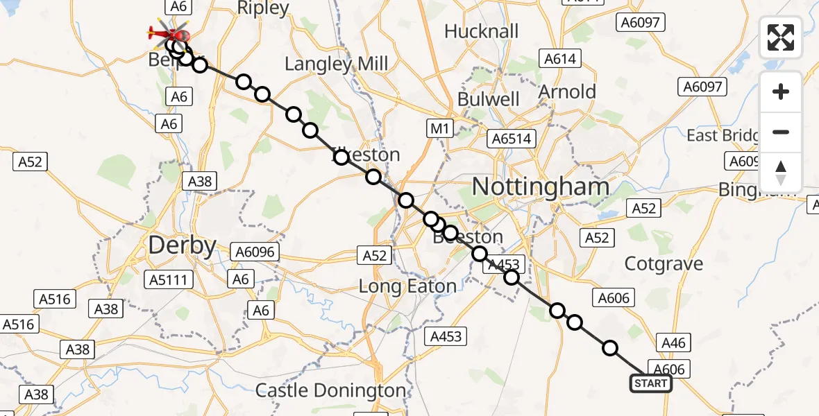
On Saturday, 17 January 2026 at 12:14, a Air Ambulance Helicopter departed from Widmerpool to Belper Lane End. It was the Air Ambulance Helicopter with registration number G-DRLA. The flight lasted 10 minutes. During that period, the aircraft travelled 24 miles at an average speed of 154 miles per hour at a maximum altitude of 1150 feet.
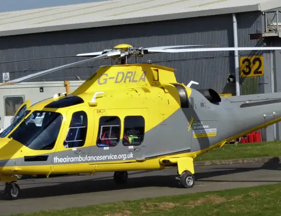
Helicopter: G-DRLA
The helicopter G-DRLA is used as an ambulance helicopter. The helicopter is equipped with a stretcher for transporting patients. The helicopter is often used to transport to hospitals.
Photo: Alec Wilson
25 miles
1150 feet
154 mph
10 minutes
12:14
12:23

Route
Belper Lane, Belper CP12:23
Belper CP, Amber Valley12:23
Belper Lane End, Belper CP12:23
Belper CP, Amber Valley12:22
Openwoodgate, Belper CP12:21
Belper CP, Amber Valley12:21
Openwoodgate, Belper CP12:21
Denby CP, Amber Valley12:20
Horsley Woodhouse CP, Amber Valley12:20
Smalley CP, Heanor12:19
Mapperley, Amber Valley12:19
Kirk Hallam, Erewash12:19
Ilkeston, Erewash12:18
Trowell, Broxtowe12:18
Bramcote, Broxtowe12:17
Bramcote, City of Nottingham12:17
Bramcote, Broxtowe12:17
Beeston, City of Nottingham12:17
City of Nottingham, East Midlands12:16
Ruddington, Rushcliffe12:15
Bradmore, Rushcliffe12:15
Keyworth, Rushcliffe12:14
Penn Lane, Rushcliffe12:14
Today
Police Helicopter to Epping Forest, Green Lane26 Feb 23:43
Flights Widmerpool
Air Ambulance Helicopter to East Leake, Ash Lane22 Feb 16:31
Air Ambulance Helicopter to Derby, Olive Street20 Feb 15:32
Air Ambulance Helicopter to Derby, Vernongate20 Feb 14:21
Air Ambulance Helicopter to Mackworth, Brun Lane17 Feb 13:27
Helicopter flights on your website?
You can easily display helicopter flights on your own website. Use the embed code.
