Air Ambulance Helicopter to Plenmeller with Whitfield
Saturday, 17 January 2026 | 11:48 | From Knaresdale with Kirkhaugh
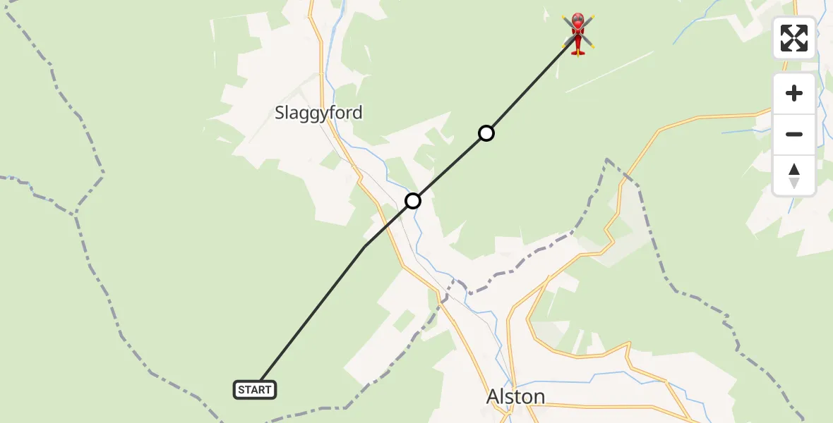
On Saturday, 17 January 2026 at 11:48, a Air Ambulance Helicopter departed from Knaresdale with Kirkhaugh to Plenmeller with Whitfield. It was the Air Ambulance Helicopter with registration number G-NHAE. The flight lasted 2 minutes. During that period, the aircraft travelled 6 miles at an average speed of 173 miles per hour at a maximum altitude of 3250 feet.
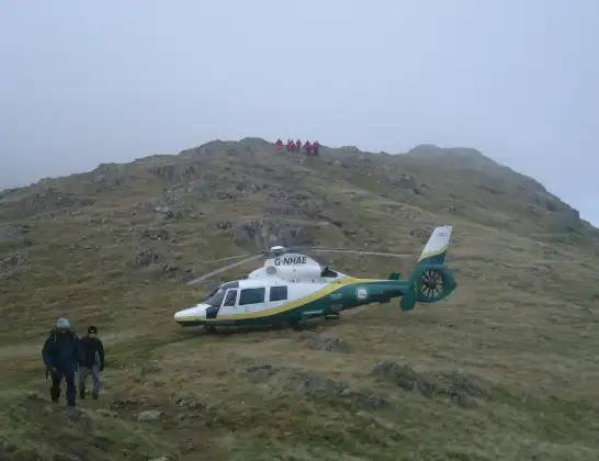
Helicopter: G-NHAE
The helicopter G-NHAE is used as a air ambulance helicopter. The main purpose of this aircraft is to transport a Mobile Medical Team to an incident as quickly as possible, enabling the trauma doctor to provide immediate first aid on site. The aircraft is flying this flight as Air Ambulance Helicopter.
Photo: Michael Earnshaw
7 miles
3250 feet
173 mph
3 minutes
11:48
11:50

Route
Plenmeller with Whitfield, North East11:50
Knaresdale with Kirkhaugh, North East11:49
Slaggyford, North East11:49
Knaresdale with Kirkhaugh, North East11:48
Live flights
Police Helicopter on its way from Wrenthorpe15 Jul 23:36
Helicopter flights on your website?
You can easily display helicopter flights on your own website. Use the embed code.
