Air Ambulance Aircraft to Dingwall, Aberdeen International Airport
Saturday, 17 January 2026 | 10:41 | From Aberdeen International Airport
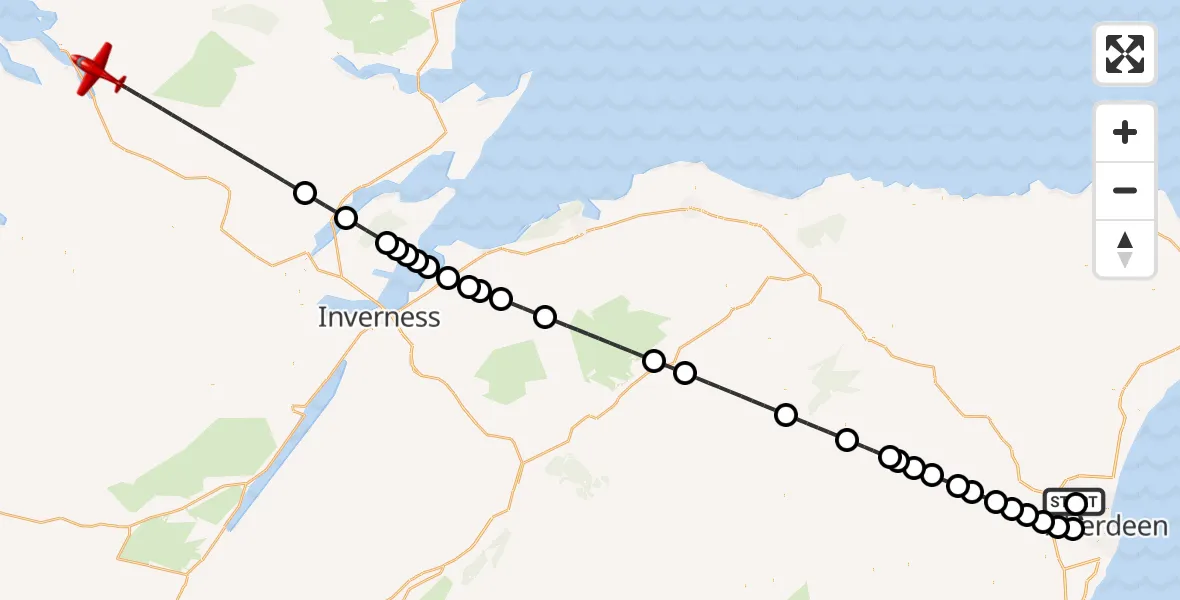
On Saturday, 17 January 2026 at 10:41, a Air Ambulance Aircraft departed from Aberdeen International Airport to Dingwall. It was the Air Ambulance Aircraft with registration number G-SASD. The flight lasted 26 minutes. During that period, the aircraft travelled 122 miles at an average speed of 278 miles per hour at a maximum altitude of 16025 feet.
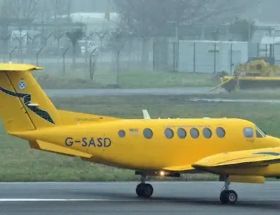
Helicopter: G-SASD
The aircraft G-SASD is used as an air ambulance aircraft. The main purpose of this aircraft is to transport a Mobile Medical Team to an incident as quickly as possible, enabling the trauma doctor to provide immediate first aid on site. The aircraft is flying this flight as Air Ambulance Aircraft.
Photo: Albert Bridge
122 miles
16025 feet
278 mph
27 minutes
10:41
11:07

Route
11:07
Dingwall11:02
Evanton11:01
Killen11:00
Fortrose11:00
Avoch11:00
Rosemarkie11:00
Inverness10:59
Inverness Airport, Inverness10:59
Clephanton10:58
Cawdor10:58
Bruachmary10:58
Ferness10:57
Advie10:54
Ballindalloch10:53
Cabrach10:51
Lumsden10:50
Bridge of Alford10:48
Keig10:48
Alford10:48
Whitehouse10:47
Monymusk10:46
Sauchen10:46
Dunecht10:45
Lyne of Skene10:45
Kirkton of Skene10:44
Elrick, Westhill10:44
Kingswells, Aberdeen City10:43
Countesswells, Aberdeen City10:43
Aberdeen City10:41
Aberdeen International Airport, Aberdeen10:41
Live flights
Today
Flights Dingwall
Air Ambulance Helicopter to Dingwall18 Jun 10:13
Air Ambulance Helicopter to Dingwall26 May 09:06
Air Ambulance Helicopter to Dingwall5 May 10:09
Coastguard Helicopter to Dingwall, A83428 Apr 14:16
Air Ambulance Helicopter to Dingwall, Rosemarkie26 Feb 13:42
Air Ambulance Helicopter to Dingwall, Ardersier18 Feb 11:34
Air Ambulance Helicopter to Dingwall29 Jan 16:39
Helicopter flights on your website?
You can easily display helicopter flights on your own website. Use the embed code.
