Air Ambulance Helicopter to Great Dalby, Ashby Folville Road
Friday, 16 January 2026 | 15:44 | From Coventry Airport
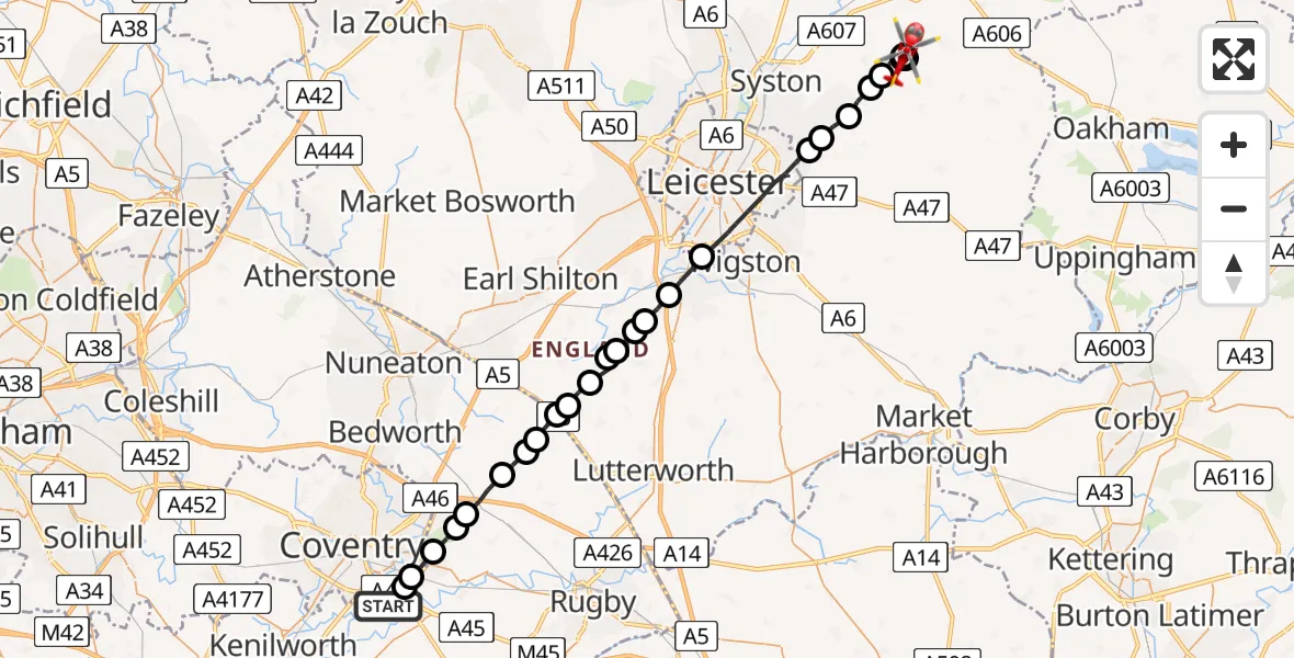
On Friday, 16 January 2026 at 15:44, a Air Ambulance Helicopter departed from Coventry Airport to Great Dalby. It was the Air Ambulance Helicopter with registration number G-WNAS. The flight lasted 12 minutes. During that period, the aircraft travelled 34 miles at an average speed of 167 miles per hour at a maximum altitude of 1525 feet.
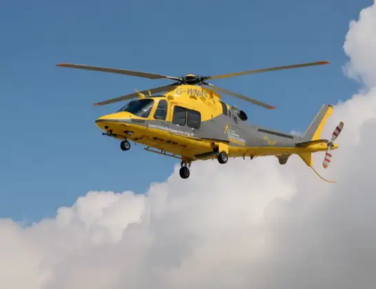
Helicopter: G-WNAS
The helicopter G-WNAS is used as an ambulance helicopter. The helicopter is equipped with a stretcher for transporting patients. The helicopter is often used to transport to hospitals.
Photo: Tony Melony
35 miles
1525 feet
167 mph
13 minutes
15:44
15:56

Route
Ashby Folville Road, Melton15:56
Great Dalby, Melton15:56
Ashby Folville, Melton15:56
Thorpe Satchville, Melton15:56
Ashby Folville, Melton15:55
Barsby, Charnwood15:55
South Croxton, Charnwood15:54
Beeby, Charnwood15:54
Scraptoft, Harborough15:53
Leicester15:51
Whetstone15:50
Cosby15:50
Broughton Astley, Harborough15:50
Broughton Astley, Leicester15:49
Harborough15:49
Frolesworth, Harborough15:49
Claybrooke Magna, Harborough15:48
Harborough15:48
Rugby15:47
Monks Kirby CP, Rugby15:47
Withybrook CP, Rugby15:47
Rugby15:46
Coventry15:46
Rugby15:45
Coventry, West Midlands15:45
Rugby15:44
Siskin Parkway West, Warwick15:44
Today
Police Helicopter to Epping Forest, Green Lane26 Feb 23:43
Helicopter flights on your website?
You can easily display helicopter flights on your own website. Use the embed code.
