Police Helicopter to Pamphill, Pamphill
Friday, 16 January 2026 | 14:50 | From Furzehill
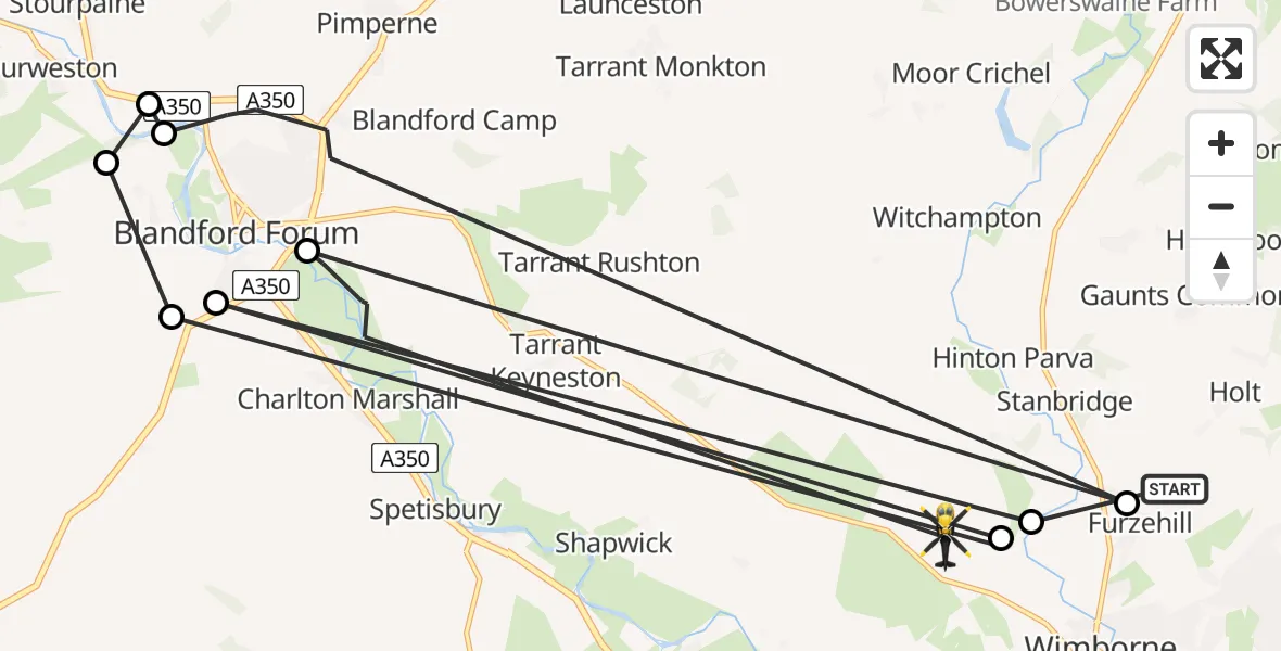
On Friday, 16 January 2026 at 14:50, a Police Helicopter departed from Furzehill to Pamphill. It was the Police Helicopter with registration number G-CPAO. The flight lasted 10 minutes. During that period, the aircraft travelled 50 miles at an average speed of 301 miles per hour at a maximum altitude of 1250 feet.
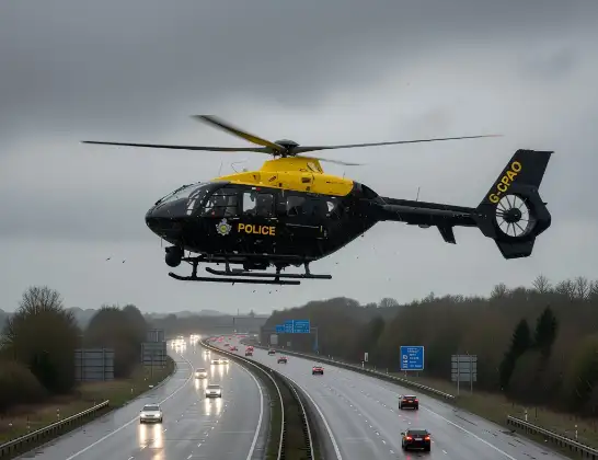
Helicopter: G-CPAO
The helicopter G-CPAO is used by the British police. The helicopter is deployed in pursuits, missing persons cases and other incidents where a helicopter provides added value.
Photo: Tony Melony
51 miles
1250 feet
301 mph
11 minutes
14:50
15:00

Route
Pamphill, 15:00
Blandford Forum14:58
Furzehill14:57
Blandford Forum14:56
Stourpaine14:55
Bryanston14:55
Blandford St. Mary14:54
Pamphill14:53
Blandford St. Mary14:53
Pamphill14:53
Furzehill, 14:50
Today
Police Helicopter to Epping Forest, Green Lane26 Feb 23:43
Flights Pamphill
Police Helicopter to Pamphill, Pamphill16 Jan 14:50
Flights Furzehill
Police Helicopter to Pamphill, Pamphill16 Jan 14:50
Police Helicopter to Furzehill, Furzehill16 Jan 14:17
Helicopter flights on your website?
You can easily display helicopter flights on your own website. Use the embed code.
