Air Ambulance Helicopter to RAF Topcliffe, RAF Topcliffe
Friday, 16 January 2026 | 13:37 | From Thirsk
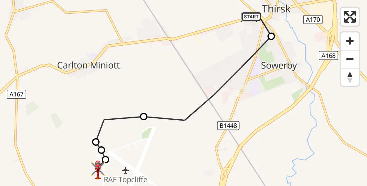
On Friday, 16 January 2026 at 13:37, a Air Ambulance Helicopter departed from Thirsk to RAF Topcliffe. It was the Air Ambulance Helicopter with registration number G-YAAA. The flight lasted 4 minutes. During that period, the aircraft travelled 3 miles at an average speed of 51 miles per hour at a maximum altitude of 875 feet.
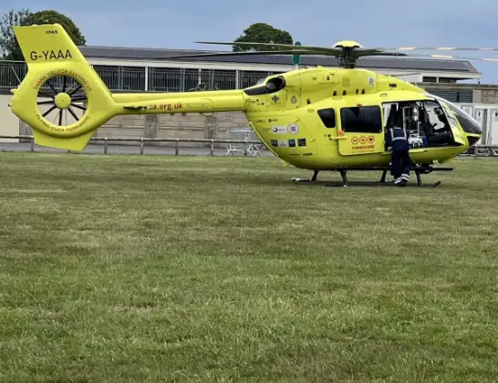
Helicopter: G-YAAA
The helicopter G-YAAA is used as a air ambulance helicopter. The main purpose of this aircraft is to transport a Mobile Medical Team to an incident as quickly as possible, enabling the trauma doctor to provide immediate first aid on site. The aircraft is flying this flight as Air Ambulance Helicopter.
Photo: Jennifer Petrie
4 miles
875 feet
51 mph
4 minutes
13:37
13:41

Route
RAF Topcliffe, Thirsk, North Yorkshire13:41
RAF Topcliffe, Thirsk, North Yorkshire13:40
Carlton Miniott, York and North Yorkshire13:39
Topcliffe, York and North Yorkshire13:39
Carlton Miniott, York and North Yorkshire13:39
Sowerby, York and North Yorkshire13:38
Station Road, York and North Yorkshire13:37
Today
Police Helicopter to Epping Forest, Green Lane26 Feb 23:43
Flights Thirsk
Air Ambulance Helicopter to Thirsk, Station Road16 Jan 13:13
Helicopter flights on your website?
You can easily display helicopter flights on your own website. Use the embed code.
