Coastguard Helicopter to Heights of Brae, Old Military Road
Friday, 16 January 2026 | 10:04 | From Inverness
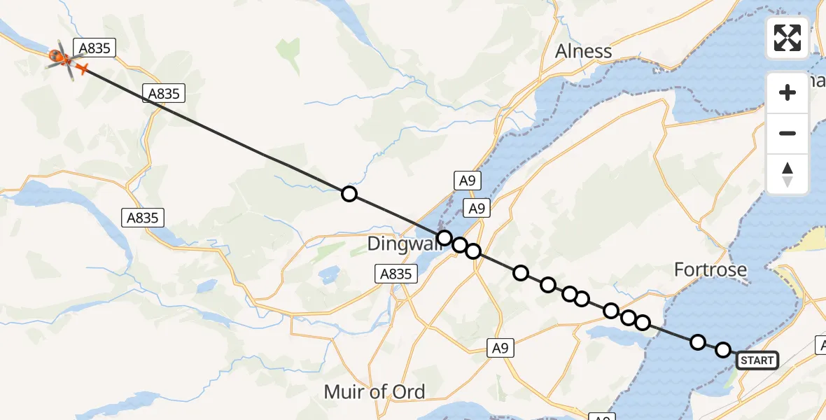
On Friday, 16 January 2026 at 10:04, a Coastguard Helicopter departed from Inverness to Heights of Brae. It was the Coastguard Helicopter with registration number G-MCGT. The flight lasted 11 minutes. During that period, the aircraft travelled 27 miles at an average speed of 144 miles per hour at a maximum altitude of 3500 feet.
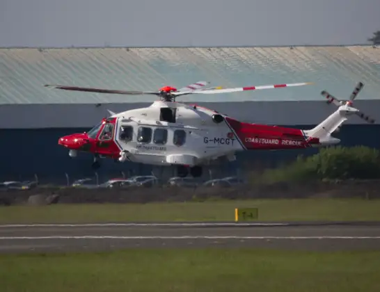
Helicopter: G-MCGT
The helicopter G-MCGT is used by the British Coastguard. The helicopter is deployed in search and rescue operations at sea, rescue operations involving ships or drilling platforms, patrols to prevent smuggling or piracy, environmental monitoring and disaster relief support.
Photo: Ronnie Macdonald
28 miles
3500 feet
144 mph
12 minutes
10:04
10:16

Route
10:16
Heights of Brae10:11
Dingwall10:10
Culbokie10:10
Tore10:09
Greenleonachs10:09
Munlochy10:08
Inverness10:08
Munlochy10:08
Inverness10:07
Avoch10:07
Inverness10:06
Avoch10:05
Fortrose10:05
Old Military Road, 10:04
Live flights
Today
Flights Inverness
Air Ambulance Aircraft to Glasgow Airport11 Jun 13:18
Helicopter flights on your website?
You can easily display helicopter flights on your own website. Use the embed code.
