Air Ambulance Helicopter to Chippenham, Cocklebury Road
Friday, 16 January 2026 | 9:27 | From Almondsbury Helicopter Base
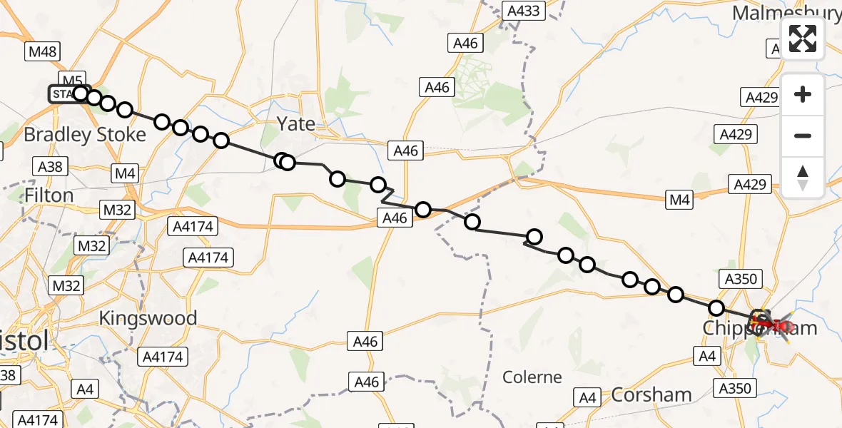
On Friday, 16 January 2026 at 9:27, a Air Ambulance Helicopter departed from Almondsbury Helicopter Base to Chippenham. It was the Air Ambulance Helicopter with registration number G-GWAC. The flight lasted 12 minutes. During that period, the aircraft travelled 25 miles at an average speed of 125 miles per hour at a maximum altitude of 1700 feet.
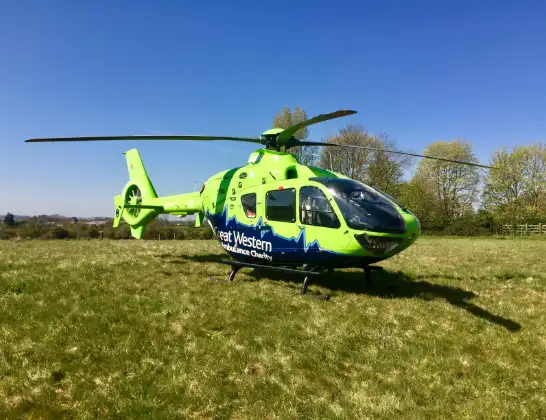
Helicopter: G-GWAC
The helicopter G-GWAC is used as a air ambulance helicopter. The main purpose of this aircraft is to transport a Mobile Medical Team to an incident as quickly as possible, enabling the trauma doctor to provide immediate first aid on site. The aircraft is flying this flight as Air Ambulance Helicopter.
Photo: Mojo0306
25 miles
1700 feet
125 mph
12 minutes
09:27
09:39

Route
Chippenham09:39
Cocklebury Road, 09:38
Cocklebury Road, 09:38
Foundry Lane, 09:38
Station Hill, 09:38
Chippenham09:35
Chippenham Without09:35
Biddestone09:34
Yatton Keynell09:34
Upper Castle Combe09:34
Castle Combe09:33
West Kington09:33
Nettleton, West of England09:32
Tormarton, West of England09:32
Dodington, West of England09:31
Codrington, West of England09:31
Wapley, West of England09:30
Wapley, Yate09:30
Nibley, West of England09:29
Westerleigh, West of England09:29
Bristol, West of England09:29
Frampton Cotterell, West of England09:28
Bradley Stoke, West of England09:28
Almondsbury, West of England09:28
Bradley Stoke, West of England09:27
M5, West of England09:27
Almondsbury Helicopter Base, Bristol, Somerset09:27
Live flights
Today
Police Helicopter to Epping Forest, Green Lane26 Feb 23:43
Flights Chippenham
Helicopter flights on your website?
You can easily display helicopter flights on your own website. Use the embed code.
