Police Helicopter to Glasgow, Forth and Clyde Canal Glasgow Spur Towpath
Thursday, 15 January 2026 | 23:05 | From City of Edinburgh
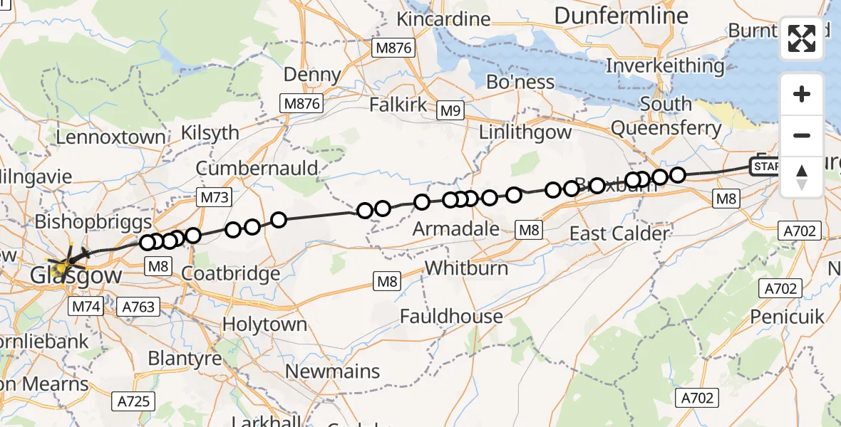
On Thursday, 15 January 2026 at 23:05, a Police Helicopter departed from City of Edinburgh to Glasgow. It was the Police Helicopter with registration number G-PSHU. The flight lasted 19 minutes. During that period, the aircraft travelled 40 miles at an average speed of 127 miles per hour at a maximum altitude of 2425 feet.
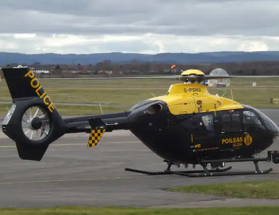
Helicopter: G-PSHU
The helicopter G-PSHU is used by the British police. The helicopter is deployed in pursuits, missing persons cases and other incidents where a helicopter provides added value.
Photo: James from Cheltenham, Gloucestershire
41 miles
2425 feet
127 mph
20 minutes
23:05
23:24

Route
Forth and Clyde Canal Glasgow Spur Towpath, 23:24
Glasgow23:22
Cardowan23:22
Stepps23:21
Muirhead23:21
Gartcosh23:21
Glenboig23:20
Glenmavis23:19
Wattston23:19
Longriggend23:16
Limerigg23:16
Blackridge23:15
Armadale23:14
Westfield23:13
Armadale23:13
Torphichen23:13
Bathgate23:12
North Mains23:11
West Binny23:11
Uphall23:10
Broxburn23:09
City of Edinburgh23:09
Newbridge, City of Edinburgh23:08
Ratho Station, City of Edinburgh23:08
Ravelston Dykes, 23:05
Today
Police Helicopter to Epping Forest, Green Lane26 Feb 23:43
Flights Glasgow
Police Helicopter to Glasgow, Loanbank Quadrant26 Feb 18:08
Police Helicopter to Glasgow, South Street26 Feb 10:53
Police Helicopter to Glasgow, M826 Feb 10:15
to Glasgow, Glasgow25 Feb 14:22
Police Helicopter to Glasgow, George Square25 Feb 14:12
Police Helicopter to Glasgow, Castlebank Street25 Feb 12:08
Police Helicopter to Glasgow, Clyde Tunnel24 Feb 19:12
Police Helicopter to Caldermill, Ardochrig Road24 Feb 18:13
Helicopter flights on your website?
You can easily display helicopter flights on your own website. Use the embed code.
