Police Helicopter to City of Edinburgh, Albion Road
Thursday, 15 January 2026 | 22:25 | From Plains
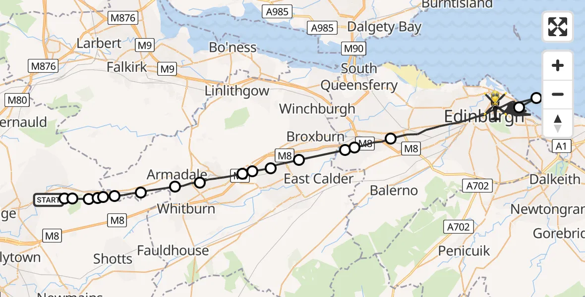
On Thursday, 15 January 2026 at 22:25, a Police Helicopter departed from Plains to City of Edinburgh. It was the Police Helicopter with registration number G-PSHU. The flight lasted 34 minutes. During that period, the aircraft travelled 64 miles at an average speed of 114 miles per hour at a maximum altitude of 2525 feet.
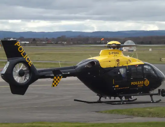
Helicopter: G-PSHU
The helicopter G-PSHU is used by the British police. The helicopter is deployed in pursuits, missing persons cases and other incidents where a helicopter provides added value.
Photo: James from Cheltenham, Gloucestershire
64 miles
2525 feet
114 mph
34 minutes
22:25
22:59

Route
Albion Road, 22:59
City of Edinburgh22:55
North Sea22:55
City of Edinburgh22:35
Ratho, City of Edinburgh22:34
City of Edinburgh22:34
Uphall Station22:33
Livingston22:32
Deans22:31
Boghall22:31
Bathgate22:30
Armadale22:29
Westrigg22:28
Blackridge22:27
Forrestfield22:27
Bentfoot22:27
Forrestfield22:27
Eastercroft22:26
Salsburgh22:26
Brownieside Road, 22:25
Today
Police Helicopter to Epping Forest, Green Lane26 Feb 23:43
Flights Plains
Helicopter flights on your website?
You can easily display helicopter flights on your own website. Use the embed code.
