Police Helicopter to Newcastle International Airport
Thursday, 15 January 2026 | 22:00 | From Seaham
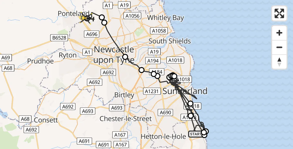
On Thursday, 15 January 2026 at 22:00, a Police Helicopter departed from Seaham to Newcastle International Airport. It was the Police Helicopter with registration number G-POLA. The flight lasted 46 minutes. During that period, the aircraft travelled 82 miles at an average speed of 107 miles per hour at a maximum altitude of 3600 feet.
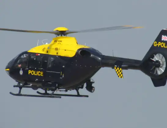
Helicopter: G-POLA
The helicopter G-POLA is used by the British police. The helicopter is deployed in pursuits, missing persons cases and other incidents where a helicopter provides added value.
Photo: ozz13x
83 miles
3600 feet
107 mph
47 minutes
22:00
22:47

Route
Newcastle International Airport, Newcastle upon Tyne, Tyne and Wear22:47
Newcastle International Airport, Newcastle upon Tyne, Tyne and Wear22:46
Dinnington, Newcastle upon Tyne22:45
Hazlerigg Village, Newcastle upon Tyne22:45
Newcastle upon Tyne, North East22:42
Pelaw, Gateshead22:41
South Tyneside, North East22:41
West Boldon, South Tyneside22:40
Sunderland, North East22:37
East Boldon, South Tyneside22:37
Sunderland, North East22:33
East Boldon, South Tyneside22:32
Sunderland, North East22:32
East Boldon, South Tyneside22:32
Sunderland, North East22:18
Seaham, North East22:16
Hawthorn, North East22:16
Seaham, North East22:08
Sunderland, North East22:01
Mulberry Way, North East22:00
Live flights
Today
Flights Seaham
Air Ambulance Helicopter to Seaham22 May 19:18
Coastguard Helicopter to Seaham, A18230 Apr 17:32
Coastguard Helicopter to Seaham, A18230 Apr 16:55
Police Helicopter to Seaham, A1930 Jan 01:31
Helicopter flights on your website?
You can easily display helicopter flights on your own website. Use the embed code.
