Air Ambulance Helicopter to Shobdon Airfield, Shobdon Airfield
Thursday, 15 January 2026 | 16:48 | From Presteigne
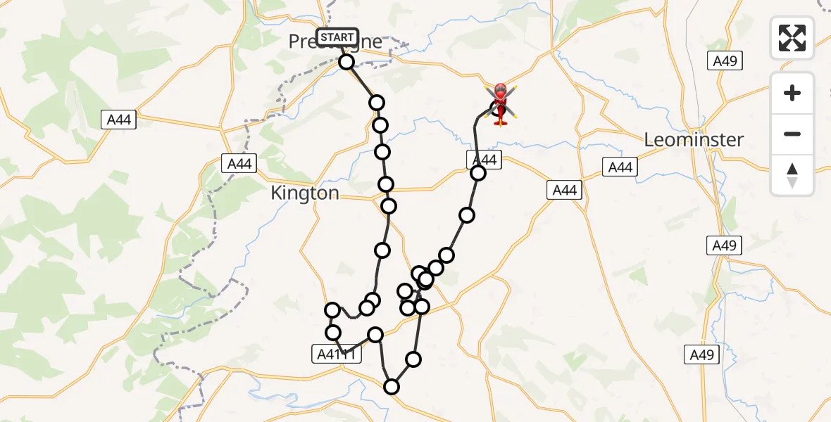
On Thursday, 15 January 2026 at 16:48, a Air Ambulance Helicopter departed from Presteigne to Shobdon Airfield. It was the Air Ambulance Helicopter with registration number G-WENU. The flight lasted 23 minutes. During that period, the aircraft travelled 28 miles at an average speed of 74 miles per hour at a maximum altitude of 2275 feet.
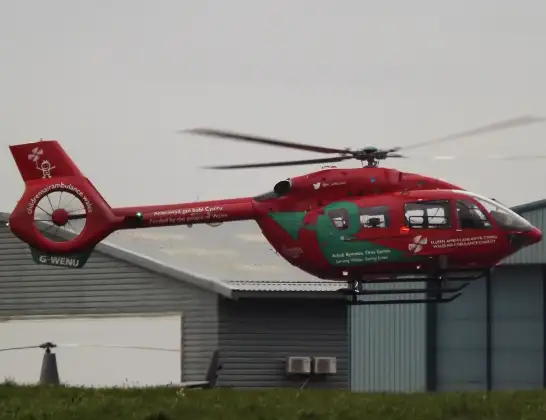
Helicopter: G-WENU
The helicopter G-WENU is used as a air ambulance helicopter. The main purpose of this aircraft is to transport a Mobile Medical Team to an incident as quickly as possible, enabling the trauma doctor to provide immediate first aid on site. The aircraft is flying this flight as Air Ambulance Helicopter.
Photo: James from Cheltenham, Gloucestershire
28 miles
2275 feet
74 mph
23 minutes
16:48
17:11

Route
Shobdon Airfield, Leominster, Herefordshire17:11
Shobdon Airfield, Leominster, Herefordshire17:09
Pembridge17:06
Bearwood17:05
Pembridge17:04
Broxwood17:03
Woonton17:03
Woonton Airstrip, Woonton17:02
Woonton17:02
Woonton Airstrip, Woonton17:02
Kinnersley17:01
Woonton17:00
Kinnersley17:00
Letton16:58
Staunton on Wye16:57
Kinnersley16:56
Eardisley16:55
Lower Welson16:54
Upcott16:53
Almeley16:53
Upcott16:52
Holme Marsh16:51
Marston16:51
Lyonshall16:50
Titley16:50
Staunton on Arrow16:49
B4355, 16:48
Presteigne16:48
Live flights
Today
Flights Presteigne
Helicopter flights on your website?
You can easily display helicopter flights on your own website. Use the embed code.
