Police Helicopter to Salfords, Kings Mill Lane
Wednesday, 14 January 2026 | 13:47 | From Albury
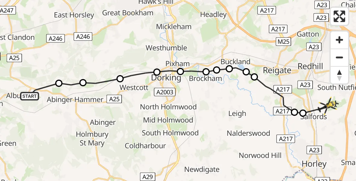
On Wednesday, 14 January 2026 at 13:47, a Police Helicopter departed from Albury to Salfords. It was the Police Helicopter with registration number G-POLH. The flight lasted 7 minutes. During that period, the aircraft travelled 16 miles at an average speed of 131 miles per hour at a maximum altitude of 1400 feet.
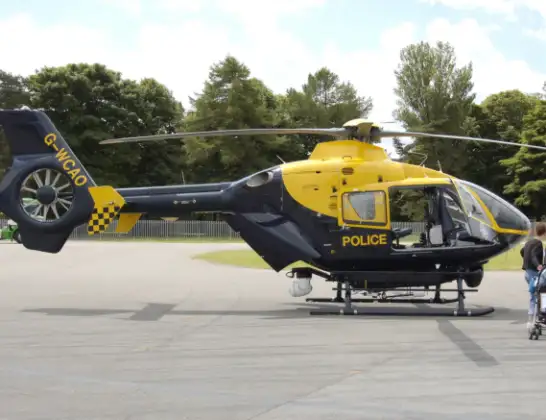
Helicopter: G-POLH
The helicopter G-POLH is used by the British police. The helicopter is deployed in pursuits, missing persons cases and other incidents where a helicopter provides added value.
Photo: Arpingstone
16 miles
1400 feet
131 mph
8 minutes
13:47
13:54

Route
Kings Mill Lane, Reigate and Banstead13:54
Salfords, Reigate and Banstead13:53
Reigate and Banstead13:53
Reigate, Reigate and Banstead13:52
Buckland, Reigate13:52
Buckland, Mole Valley13:51
Betchworth, Mole Valley13:51
Brockham, Mole Valley13:51
Pixham, Mole Valley13:50
Dorking, Mole Valley13:50
Westcott, Mole Valley13:49
Mole Valley13:48
Shere, Guildford13:48
New Road, Guildford13:47
Live flights
Today
Police Helicopter to Epping Forest, Green Lane26 Feb 23:43
Flights Salfords
Police Helicopter to Epping Forest, Mott Street26 Feb 20:04
Police Helicopter to Denham, North Orbital Road23 Feb 10:10
Police Helicopter to Shere, Towerhill Lane22 Feb 15:43
Flights Albury
Police Helicopter to Salfords, Kings Mill Lane14 Jan 13:47
Helicopter flights on your website?
You can easily display helicopter flights on your own website. Use the embed code.
