Air Ambulance Helicopter to Fen Ditton, Newmarket Road
Wednesday, 14 January 2026 | 11:40 | From West Wickham
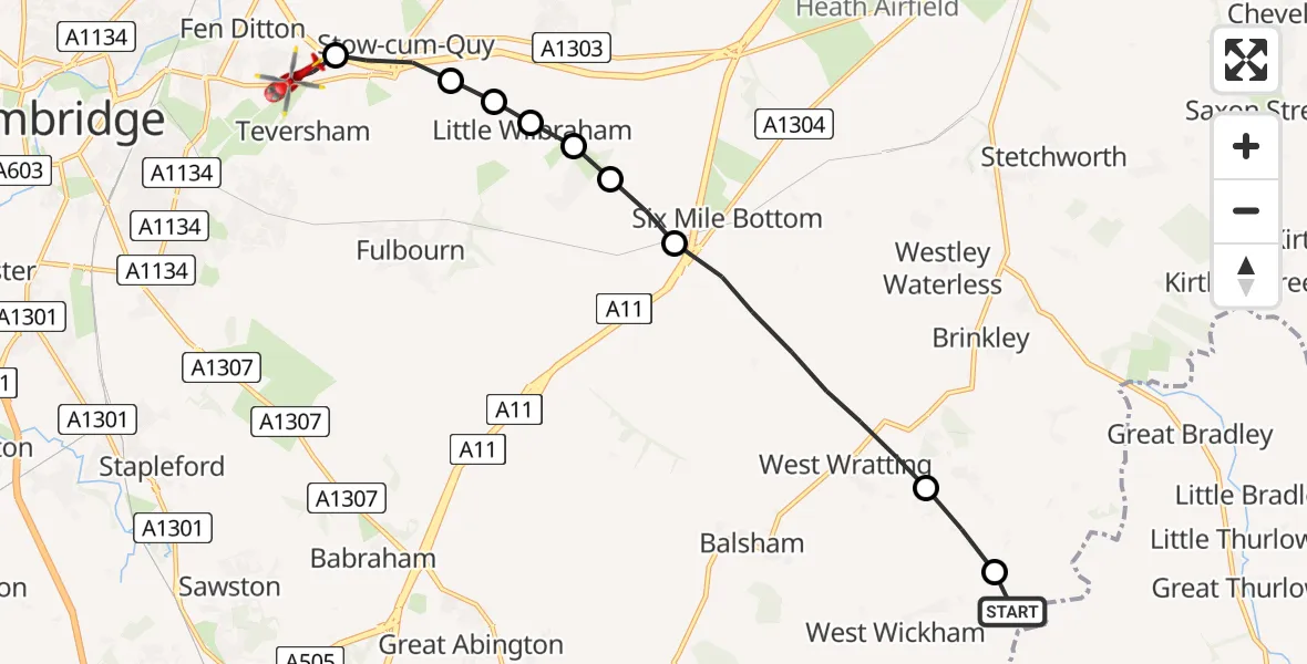
On Wednesday, 14 January 2026 at 11:40, a Air Ambulance Helicopter departed from West Wickham to Fen Ditton. It was the Air Ambulance Helicopter with registration number G-SCAA. The flight lasted 5 minutes. During that period, the aircraft travelled 11 miles at an average speed of 132 miles per hour at a maximum altitude of 1150 feet.
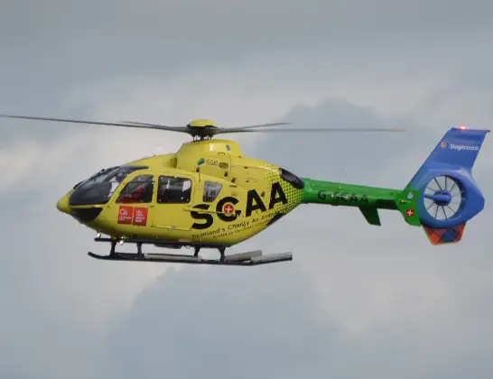
Helicopter: G-SCAA
The helicopter G-SCAA is used as a air ambulance helicopter. The main purpose of this aircraft is to transport a Mobile Medical Team to an incident as quickly as possible, enabling the trauma doctor to provide immediate first aid on site. The aircraft is flying this flight as Air Ambulance Helicopter.
Photo: Jonathan Payne
12 miles
1150 feet
132 mph
6 minutes
11:40
11:45

Route
Newmarket Road, South Cambridgeshire11:45
Fen Ditton, South Cambridgeshire11:45
Stow cum Quy, South Cambridgeshire11:44
South Cambridgeshire, Cambridgeshire and Peterborough11:44
Little Wilbraham, South Cambridgeshire11:44
South Cambridgeshire, Cambridgeshire and Peterborough11:43
Great Wilbraham, South Cambridgeshire11:43
South Cambridgeshire, Cambridgeshire and Peterborough11:43
Weston Colville, South Cambridgeshire11:41
West Wratting, South Cambridgeshire11:40
Skipper's Lane, South Cambridgeshire11:40
Today
Police Helicopter to Epping Forest, Green Lane26 Feb 23:43
Helicopter flights on your website?
You can easily display helicopter flights on your own website. Use the embed code.
