Coastguard Helicopter to Flamborough
Wednesday, 14 January 2026 | 9:48 | From Humberside Airport
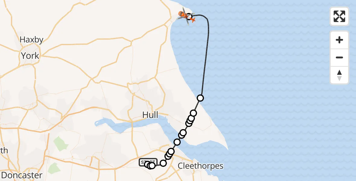
On Wednesday, 14 January 2026 at 9:48, a Coastguard Helicopter departed from Humberside Airport to Flamborough. It was the Coastguard Helicopter with registration number G-MCGY. The flight lasted 24 minutes. During that period, the aircraft travelled 50 miles at an average speed of 123 miles per hour at a maximum altitude of 2125 feet.
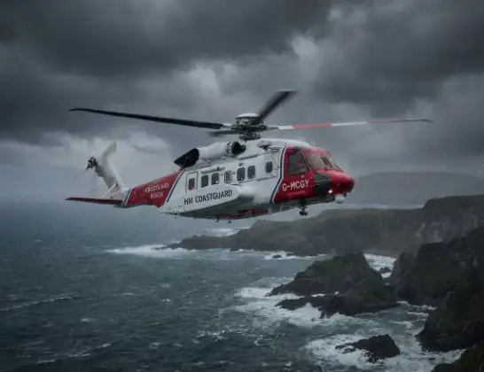
Helicopter: G-MCGY
The helicopter G-MCGY is used by the British Coastguard. The helicopter is deployed in search and rescue operations at sea, rescue operations involving ships or drilling platforms, patrols to prevent smuggling or piracy, environmental monitoring and disaster relief support.
50 miles
2125 feet
123 mph
25 minutes
09:48
10:13

Route
Flamborough, Hull and East Yorkshire10:13
Flamborough, Hull and East Yorkshire10:11
North Sea09:58
Roos, Hull and East Yorkshire09:56
Halsham, Hull and East Yorkshire09:56
Ottringham, Hull and East Yorkshire09:56
Winestead, Hull and East Yorkshire09:55
Keyingham, Hull and East Yorkshire09:54
Paull, Hull and East Yorkshire09:54
North Sea09:53
Immingham, Greater Lincolnshire09:52
Grimsby, Greater Lincolnshire09:52
Stallingborough, Greater Lincolnshire09:52
Keelby CP, West Lindsey09:51
Great Limber CP, West Lindsey09:50
West Lindsey, Greater Lincolnshire09:50
Searby, West Lindsey09:49
Humberside Airport, Grimsby, Lincolnshire09:48
Live flights
Today
Flights Flamborough
Coastguard Helicopter to Humberside Airport4 Jul 15:43
Coastguard Helicopter to Humberside Airport3 Jul 18:11
Coastguard Helicopter to North Sea18 Jun 10:21
Coastguard Helicopter to Flamborough18 Jun 09:49
Air Ambulance Helicopter to RAF Topcliffe16 Jun 12:27
Helicopter flights on your website?
You can easily display helicopter flights on your own website. Use the embed code.
