Police Helicopter to Wakefield, A650
Tuesday, 13 January 2026 | 10:28 | From East Ardsley
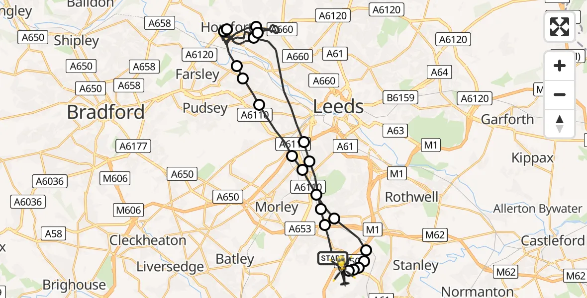
On Tuesday, 13 January 2026 at 10:28, a Police Helicopter departed from East Ardsley to Wakefield. It was the Police Helicopter with registration number G-POLB. The flight lasted 22 minutes. During that period, the aircraft travelled 28 miles at an average speed of 77 miles per hour at a maximum altitude of 1900 feet.
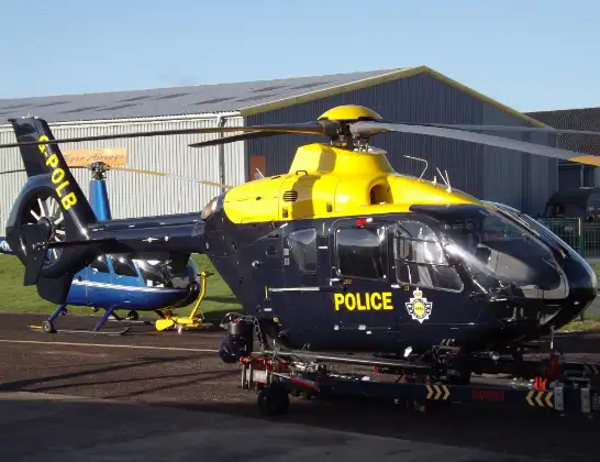
Helicopter: G-POLB
The helicopter G-POLB is used by the British police. The helicopter is deployed in pursuits, missing persons cases and other incidents where a helicopter provides added value.
Photo: James from Cheltenham, Gloucestershire
29 miles
1900 feet
77 mph
23 minutes
10:28
10:50

Route
A650, West Yorkshire10:50
Wakefield, West Yorkshire10:49
Wrenthorpe, Wakefield10:49
Wakefield, West Yorkshire10:49
Newton Hill, Wakefield10:49
Lofthouse Gate, Wakefield10:48
Thorpe-on-the-Hill, Leeds10:48
Leeds, West Yorkshire10:47
Churwell, Morley10:47
Churwell, Leeds10:46
Leeds, West Yorkshire10:45
Pudsey, Leeds10:45
Farsley, Leeds10:45
Horsforth, Leeds10:42
Rawdon, Horsforth10:42
Horsforth, Leeds10:39
Leeds, West Yorkshire10:35
Horsforth, Leeds10:31
Leeds, West Yorkshire10:30
Churwell, Leeds10:29
Leeds, West Yorkshire10:29
Tingley, Leeds10:28
Woodhouse Lane, Leeds10:28
Today
Police Helicopter to Falkirk02:12:08
Flights Wakefield
Police Helicopter to Wakefield, Stephenson Way28 Mar 00:23
Police Helicopter to Wakefield, Bradford Road24 Mar 05:03
Police Helicopter to Wakefield, Lawns Lane24 Mar 05:03
Police Helicopter to Wakefield, Lawns Lane24 Mar 05:03
Police Helicopter to Wakefield, Lawns Lane24 Mar 05:03
Police Helicopter to Wakefield, Lawns Lane24 Mar 05:03
Police Helicopter to Wakefield, Lawns Lane24 Mar 05:03
Police Helicopter to Wakefield, Lawns Lane24 Mar 05:03
Helicopter flights on your website?
You can easily display helicopter flights on your own website. Use the embed code.
