Police Helicopter to Church End, Castle Hill Road
Monday, 12 January 2026 | 15:12 | From London Borough of Bexley
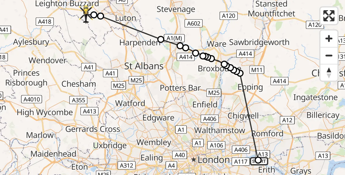
On Monday, 12 January 2026 at 15:12, a Police Helicopter departed from London Borough of Bexley to Church End. It was the Police Helicopter with registration number G-POLF. The flight lasted 14 minutes. During that period, the aircraft travelled 47 miles at an average speed of 202 miles per hour at a maximum altitude of 1600 feet.
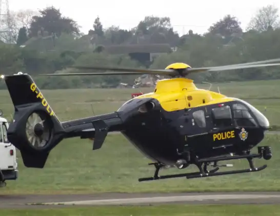
Helicopter: G-POLF
The helicopter G-POLF is used by the British police. The helicopter is deployed in pursuits, missing persons cases and other incidents where a helicopter provides added value.
Photo: James
48 miles
1600 feet
202 mph
15 minutes
15:12
15:26

Route
Castle Hill Road, 15:26
Houghton Regis15:25
Dunstable15:25
Wheathampstead, St Albans15:19
Welwyn Garden City, Welwyn Hatfield15:17
Panshanger Aerodrome, Welwyn Garden City, Hertfordshire15:17
Birch Green, East Hertfordshire15:16
Hertingfordbury, Hertford15:15
Brickendon, East Hertfordshire15:15
East Hertfordshire15:15
Hertford Heath, East Hertfordshire15:15
Hoddesdon15:14
Epping Forest, Essex15:13
Tylers Cross, Epping Forest15:13
Lower Nazeing, Epping Forest15:13
Tylers Cross, Epping Forest15:12
Epping Green, Epping Forest15:12
London Borough of Barking and Dagenham, Greater London15:12
Eastern Way, Greater London15:12
Today
Helicopter flights on your website?
You can easily display helicopter flights on your own website. Use the embed code.
