Air Ambulance Helicopter to Coventry Airport, Coventry Airport
Monday, 12 January 2026 | 13:03 | From Queen Elizabeth Hospital Helipad
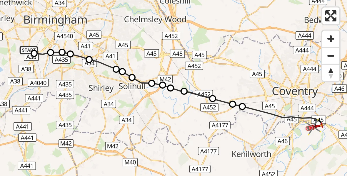
On Monday, 12 January 2026 at 13:03, a Air Ambulance Helicopter departed from Queen Elizabeth Hospital Helipad to Coventry Airport. It was the Air Ambulance Helicopter with registration number G-WNAS. The flight lasted 8 minutes. During that period, the aircraft travelled 25 miles at an average speed of 182 miles per hour at a maximum altitude of 1750 feet.
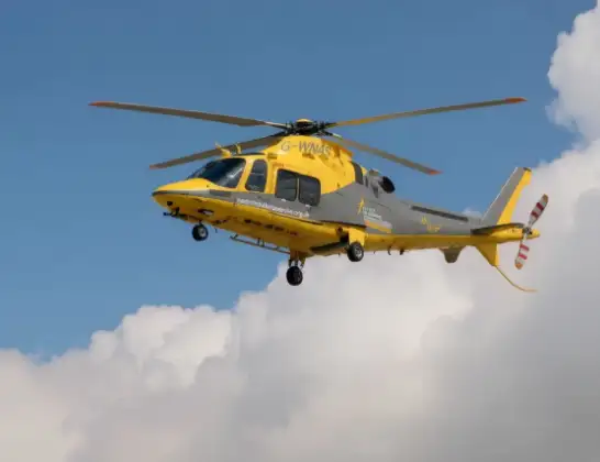
Helicopter: G-WNAS
The helicopter G-WNAS is used as an ambulance helicopter. The helicopter is equipped with a stretcher for transporting patients. The helicopter is often used to transport to hospitals.
Photo: Tony Melony
26 miles
1750 feet
182 mph
9 minutes
13:03
13:11

Route
Coventry Airport, Coventry, West Midlands13:11
Coventry Airport, Coventry, West Midlands13:11
Coventry, West Midlands13:09
Berkswell, Solihull13:08
Solihull, West Midlands13:08
Berkswell, Solihull13:08
Solihull, West Midlands13:07
Bickenhill, Solihull13:07
Hampton in Arden, Solihull13:06
Elmdon Heath, Solihull13:06
Ulverley Green, Solihull13:05
Kineton Green, Solihull13:05
Fox Hollies, Birmingham13:05
Wake Green, Birmingham13:04
Balsall Heath, Birmingham13:04
Birmingham, West Midlands13:04
Metchley, Birmingham13:03
Woodleigh Avenue, Birmingham13:03
Live flights
Today
Police Helicopter to Epping Forest, Green Lane26 Feb 23:43
Helicopter flights on your website?
You can easily display helicopter flights on your own website. Use the embed code.
