Coastguard Helicopter to North Tamerton, North Tamerton
Monday, 12 January 2026 | 9:45 | From Talskiddy
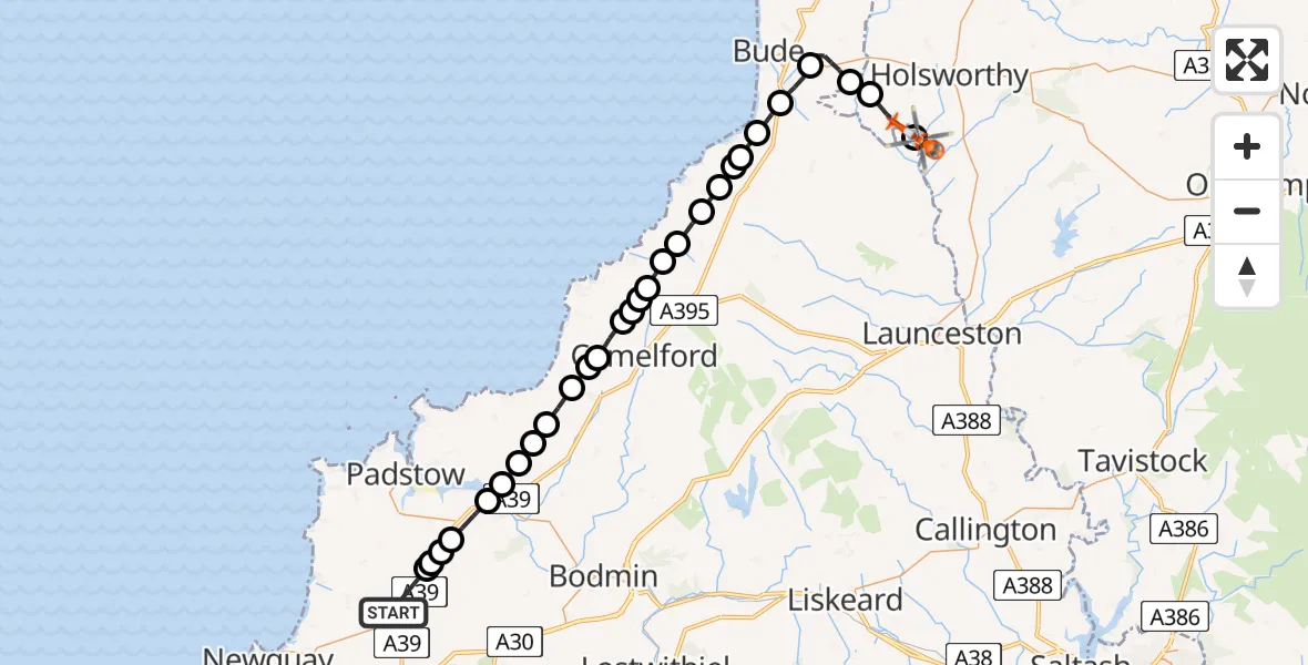
On Monday, 12 January 2026 at 9:45, a Coastguard Helicopter departed from Talskiddy to North Tamerton. It was the Coastguard Helicopter with registration number G-MCGF. The flight lasted 17 minutes. During that period, the aircraft travelled 39 miles at an average speed of 140 miles per hour at a maximum altitude of 1850 feet.
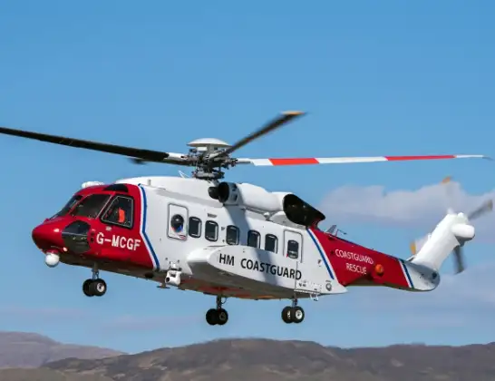
Helicopter: G-MCGF
The helicopter G-MCGF is used by the British Coastguard. The helicopter is deployed in search and rescue operations at sea, rescue operations involving ships or drilling platforms, patrols to prevent smuggling or piracy, environmental monitoring and disaster relief support.
Photo: The Carlisle Kid
40 miles
1850 feet
140 mph
17 minutes
09:45
10:02

Route
North Tamerton, 10:02
North Tamerton10:02
Torridge, Devon and Torbay10:00
Launcells10:00
Stratton09:59
Marhamchurch09:58
Widemouth Bay09:57
Poundstock09:56
St Gennys09:56
Wainhouse Corner09:56
Higher Crackington09:55
St. Juliot09:54
Lesnewth09:54
Forrabury and Minster09:53
Trevalga09:53
Camelford09:53
Treknow09:52
Delabole09:52
Treligga09:51
St Teath09:51
St. Kew09:50
St Kew09:49
Chapel Amble09:49
Bodieve09:48
Bodieve, Wadebridge09:48
Whitecross09:47
Tremayne, St. Columb Major09:47
St Issey09:46
Tremayne, St. Columb Major09:46
Talskiddy, St. Columb Major09:45
Today
Police Helicopter to Epping Forest, Green Lane26 Feb 23:43
Flights Talskiddy
Helicopter flights on your website?
You can easily display helicopter flights on your own website. Use the embed code.
