Air Ambulance Helicopter to Throop, Throop Road
Sunday, 11 January 2026 | 22:43 | From Henstridge Airfield
On Sunday, 11 January 2026 at 22:43, a Air Ambulance Helicopter departed from Henstridge Airfield to Throop. It was the Air Ambulance Helicopter with registration number G-DSAA. The flight lasted 15 minutes. During that period, the aircraft travelled 31 miles at an average speed of 125 miles per hour at a maximum altitude of 1400 feet.
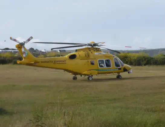
Helicopter: G-DSAA
The helicopter G-DSAA is used as a air ambulance helicopter. The main purpose of this aircraft is to transport a Mobile Medical Team to an incident as quickly as possible, enabling the trauma doctor to provide immediate first aid on site. The aircraft is flying this flight as Air Ambulance Helicopter.
Photo: Andrew Bone
32 miles
1400 feet
125 mph
16 minutes
22:43
22:58

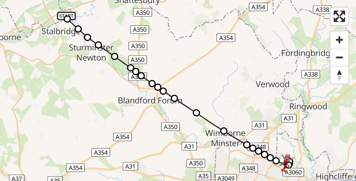
Route
Throop Road, Bournemouth22:58
Throop, Bournemouth22:56
Hurn22:55
Throop, Bournemouth22:54
Hurn22:54
Throop, Bournemouth22:53
Parley Cross22:53
Kinson, Bournemouth22:53
Dudsbury, Ferndown22:53
Hampreston22:52
Merley, Poole22:52
Wimborne Minster22:51
Pamphill22:50
Tarrant Rushton22:49
Blandford Camp22:48
Pimperne22:48
Blandford Forum22:48
Stourpaine22:47
Shroton22:47
Hanford22:47
Child Okeford22:46
Manston22:45
Hinton St Mary22:45
Marnhull22:44
Stalbridge, 22:44
Stalbridge22:44
Henstridge Airfield, Templecombe, Somerset22:43
Live flights
Police Helicopter on its way from Dundrod12 Jul 22:50
Today
Police Helicopter to East Ardsley, Stoney Lane12 Jul 23:51
Police Helicopter to Birmingham Airport12 Jul 23:46
Air Ambulance Helicopter to Newlands of Culloden12 Jul 23:24
Flights Throop
Police Helicopter to Bournemouth Airport20 Mar 15:10
Police Helicopter to Bournemouth Airport14 Mar 00:21
Police Helicopter to Bournemouth Airport6 Mar 13:58
Police Helicopter to Bournemouth Airport2 Mar 20:51
Police Helicopter to Bournemouth Airport1 Mar 14:14
Air Ambulance Helicopter to Henstridge Airfield16 Feb 02:26
Police Helicopter to Bournemouth Airport30 Jan 16:37
Police Helicopter to Bournemouth Airport25 Jan 22:31
Air Ambulance Helicopter to Henstridge Airfield23 Jan 16:03
Helicopter flights on your website?
You can easily display helicopter flights on your own website. Use the embed code.
