Air Ambulance Helicopter to Aberdaron, Pont Rhyd y Cei
Saturday, 10 January 2026 | 22:53 | From Caernarfon Airport
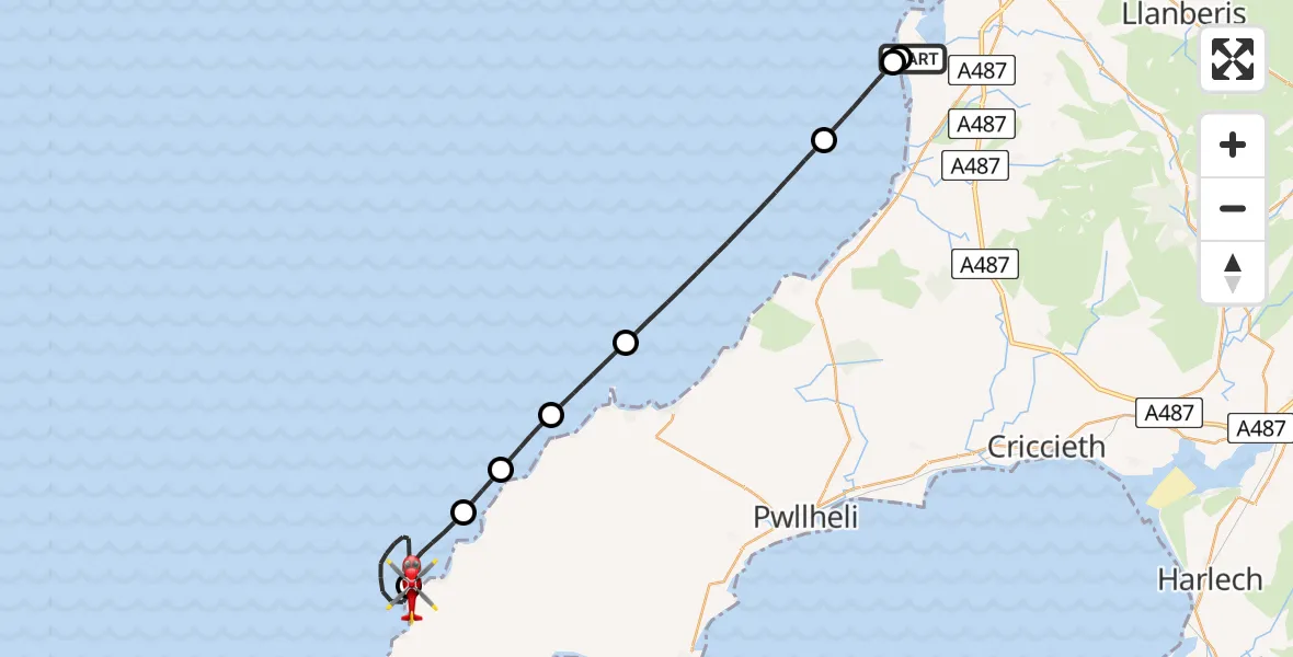
On Saturday, 10 January 2026 at 22:53, a Air Ambulance Helicopter departed from Caernarfon Airport to Aberdaron. It was the Air Ambulance Helicopter with registration number G-WROL. The flight lasted 23 minutes. During that period, the aircraft travelled 29 miles at an average speed of 75 miles per hour at a maximum altitude of 1150 feet.
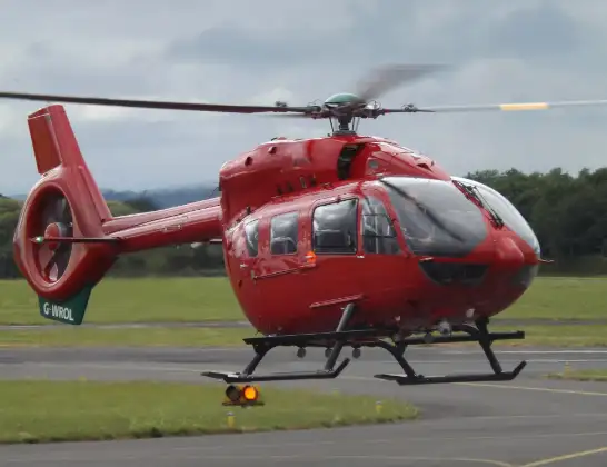
Helicopter: G-WROL
The helicopter G-WROL is used as a air ambulance helicopter. The main purpose of this aircraft is to transport a Mobile Medical Team to an incident as quickly as possible, enabling the trauma doctor to provide immediate first aid on site. The aircraft is flying this flight as Air Ambulance Helicopter.
Photo: James from Cheltenham, Gloucestershire
29 miles
1150 feet
75 mph
24 minutes
22:53
23:16

Route
Pont Rhyd y Cei, 23:16
Aberdaron23:09
Tudweiliog23:07
Porth Ychain23:06
Tudweiliog23:05
Morfa Nefyn23:03
Irish Sea22:58
Dinas Dinlle, 22:56
Llanfaglan22:56
Caernarfon Airport, Caernarfon22:53
Live flights
Today
Police Helicopter to Epping Forest, Green Lane26 Feb 23:43
Flights Aberdaron
Air Ambulance Helicopter to University Hospital North Staffs, University Hospital North Staffs11 Jan 01:29
Helicopter flights on your website?
You can easily display helicopter flights on your own website. Use the embed code.
