Coastguard Helicopter to Wasdale, Old Corpse Road
Saturday, 10 January 2026 | 15:24 | From Burnhead
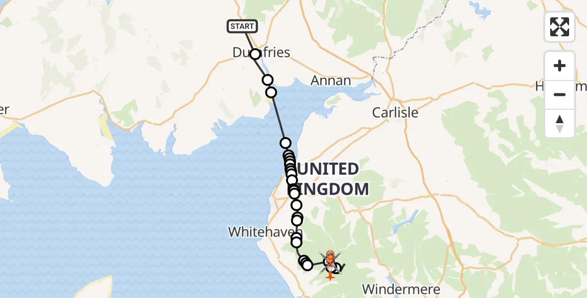
On Saturday, 10 January 2026 at 15:24, a Coastguard Helicopter departed from Burnhead to Wasdale. It was the Coastguard Helicopter with registration number G-MCGS. The flight lasted 37 minutes. During that period, the aircraft travelled 68 miles at an average speed of 112 miles per hour at a maximum altitude of 1975 feet.
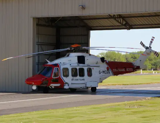
Helicopter: G-MCGS
The helicopter G-MCGS is used by the British Coastguard. The helicopter is deployed in search and rescue operations at sea, rescue operations involving ships or drilling platforms, patrols to prevent smuggling or piracy, environmental monitoring and disaster relief support.
69 miles
1975 feet
112 mph
37 minutes
15:24
16:01

Route
Old Corpse Road, 16:01
Wasdale16:00
Eskdale15:55
Wasdale15:50
Gosforth15:47
Ennerdale and Kinniside15:47
Wasdale15:47
Ennerdale and Kinniside15:45
Ennerdale Bridge15:44
Kirkland15:43
Lingcroft Grass Airstrip, Workington, Cumbria15:43
Ullock15:42
Greysouthen15:41
Camerton15:40
Great Broughton15:40
Broughton Moor15:39
Dearham15:39
Birkby15:39
Birkby, Maryport15:38
Birkby15:38
Crosby15:38
Birkby15:37
Maryport15:37
Irish Sea15:36
Carsethorn15:31
Ingleston15:30
Dumfries15:26
C113n, 15:24
Today
Police Helicopter to Epping Forest, Green Lane26 Feb 23:43
Flights Wasdale
Coastguard Helicopter to Wasdale, Wasdale29 Jan 16:11
Coastguard Helicopter to Wasdale, Wasdale29 Jan 14:29
Coastguard Helicopter to Wasdale, Wasdale10 Jan 16:20
Coastguard Helicopter to Wasdale, Wasdale10 Jan 16:09
Flights Burnhead
Helicopter flights on your website?
You can easily display helicopter flights on your own website. Use the embed code.
