Police Helicopter to Salfords, Axes Lane
Saturday, 10 January 2026 | 13:45 | From Three Bridges
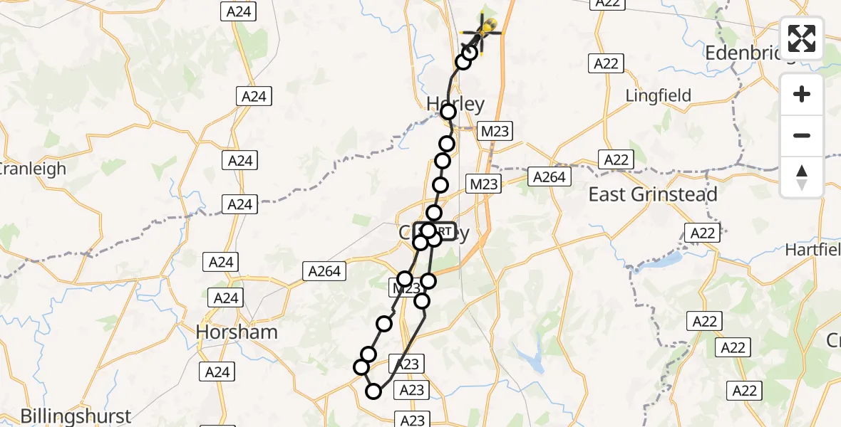
On Saturday, 10 January 2026 at 13:45, a Police Helicopter departed from Three Bridges to Salfords. It was the Police Helicopter with registration number G-POLH. The flight lasted 9 minutes. During that period, the aircraft travelled 19 miles at an average speed of 133 miles per hour at a maximum altitude of 1300 feet.
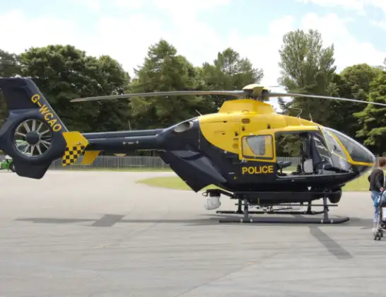
Helicopter: G-POLH
The helicopter G-POLH is used by the British police. The helicopter is deployed in pursuits, missing persons cases and other incidents where a helicopter provides added value.
Photo: Arpingstone
19 miles
1300 feet
133 mph
9 minutes
13:45
13:54

Route
Axes Lane, Reigate and Banstead13:54
Salfords, Reigate and Banstead13:54
Reigate and Banstead13:53
Horley, Reigate and Banstead13:53
London Gatwick Airport, London13:52
Tinsley Green, Crawley13:52
Manor Royal, Crawley13:51
Northgate, Crawley13:51
Tilgate, Crawley13:51
Southgate, Crawley13:51
Broadfield, Crawley13:50
Slaugham, Mid Sussex13:49
Horsham13:49
Lower Beeding, Horsham13:48
Slaugham, Horsham13:48
Slaugham, Mid Sussex13:46
Maidenbower, Crawley13:46
Tilgate, Crawley13:46
Hawth Woods Path, Crawley13:45
Today
Police Helicopter to Epping Forest, Green Lane26 Feb 23:43
Flights Salfords
Police Helicopter to Epping Forest, Mott Street26 Feb 20:04
Police Helicopter to Denham, North Orbital Road23 Feb 10:10
Police Helicopter to Shere, Towerhill Lane22 Feb 15:43
Helicopter flights on your website?
You can easily display helicopter flights on your own website. Use the embed code.
