Police Helicopter to Havant, Springwood Avenue
Saturday, 10 January 2026 | 8:27 | From Winchester
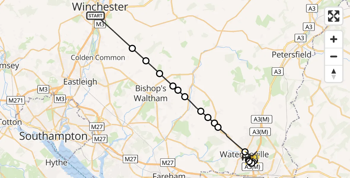
On Saturday, 10 January 2026 at 8:27, a Police Helicopter departed from Winchester to Havant. It was the Police Helicopter with registration number G-BZRS. The flight lasted 10 minutes. During that period, the aircraft travelled 21 miles at an average speed of 130 miles per hour at a maximum altitude of 1400 feet.
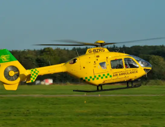
Helicopter: G-BZRS
The helicopter G-BZRS is used by the British police. The helicopter is deployed in pursuits, missing persons cases and other incidents where a helicopter provides added value.
Photo: NMOS332
22 miles
1400 feet
130 mph
10 minutes
08:27
08:37

Route
Havant08:37
Springwood Avenue, 08:37
Campion Close, 08:36
Mole Hill, 08:36
Waterlooville08:35
Lantana Close, 08:35
Stakes Hill Road, Havant08:34
Havant08:34
Waterlooville08:34
Denmead, Winchester08:33
Hambledon, Winchester08:32
Winchester08:32
Soberton Heath, Winchester08:32
Soberton, Winchester08:31
Swanmore, Winchester08:31
Droxford, Winchester08:31
Bishop's Waltham, Winchester08:30
Upham, Winchester08:30
Owslebury, Winchester08:29
Saint Faith's Road, 08:27
Live flights
Today
Flights Havant
Air Ambulance Helicopter to Havant, Mengham16 Jun 16:38
Coastguard Helicopter to Solent Airport10 Jun 16:10
Air Ambulance Helicopter to Havant, A278 Jun 09:08
Flights Winchester
Air Ambulance Helicopter to Southampton Airport10 Jun 11:13
Helicopter flights on your website?
You can easily display helicopter flights on your own website. Use the embed code.
