Police Helicopter to Newcastle upon Tyne, Stamfordham Road
Saturday, 10 January 2026 | 1:11 | From Newcastle upon Tyne
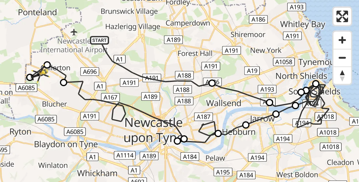
On Saturday, 10 January 2026 at 1:11, a Police Helicopter departed from Newcastle upon Tyne to Newcastle upon Tyne. It was the Police Helicopter with registration number G-POLA. The flight lasted 30 minutes. During that period, the aircraft travelled 47 miles at an average speed of 93 miles per hour at a maximum altitude of 2000 feet.
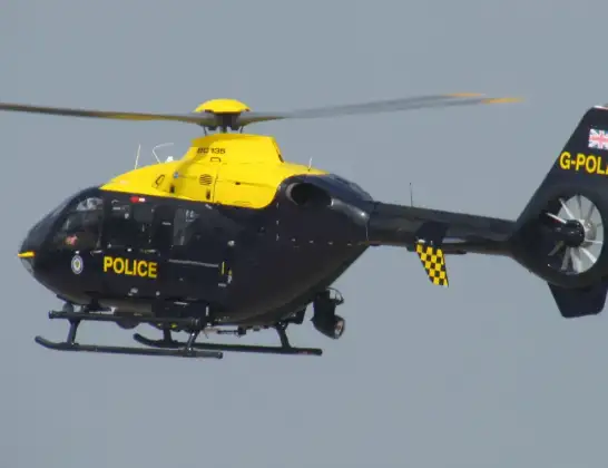
Helicopter: G-POLA
The helicopter G-POLA is used by the British police. The helicopter is deployed in pursuits, missing persons cases and other incidents where a helicopter provides added value.
Photo: ozz13x
48 miles
2000 feet
93 mph
31 minutes
01:11
01:42

Route
Stamfordham Road, North East01:42
Heddon-on-the-Wall, North East01:41
Newcastle upon Tyne, North East01:41
Callerton, Newcastle upon Tyne01:40
Newcastle upon Tyne, North East01:36
Gateshead, North East01:36
Newcastle upon Tyne, North East01:33
Hebburn, South Tyneside01:32
Jarrow, South Tyneside01:31
North Shields, North Tyneside01:31
South Shields, South Tyneside01:22
North Shields, North Tyneside01:22
South Shields, South Tyneside01:17
North Shields, North Tyneside01:16
Wallsend, North Tyneside01:14
Newcastle upon Tyne, North East01:11
Live flights
Today
Police Helicopter to Viewpark16:41:01
Helicopter flights on your website?
You can easily display helicopter flights on your own website. Use the embed code.
